Monday, May 18, 2015

Devil Habitat


Entering the 'den' area
Devil's Den State Park, Arkansas


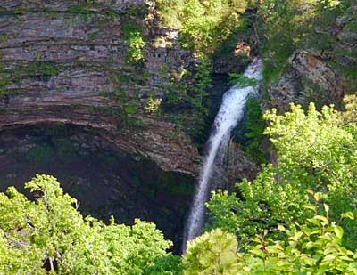
Perhaps you have never contemplated what might constitute ‘devil’ habitat and what the survival requirements of the horned one might be.  Well, spending a few days at Devil’s Den State Park has inspired me to give it some thought.  There would probably be no need for water, not sure what if any food would be necessary, high heat seems to come to mind whether the sun, geothermal features or both are the source is not known, rough rocks, dark crevices and caves for shelter would be needed and of course lots of space to enjoy it all.  But personally I would not have pictured the devil living in such beauty as we found at Devil’s Den State Park in the Boston Mountains of northwest Arkansas.


Crack in the sandstone rocks leading into a crevice 'cave'


Leaving the diverse plant and animal life and the springs and creeks out of the picture, the geology of Devil’s Den State Park does fit the name.  Lee’s Creek cut this beautiful valley through sandstone formations in the Ozark Mountains between 10,000 – 70,000 years ago.  Over time the creek removed enough sandstone to cause corners of the mountainside to break off, crack and slide causing jumbles of rocks and eventually creating many interconnected crevices and caves.  The effect today is a series of dark depressions, sandstone crevice caves and tumbled rocks tucked into a luscious valley of creeks and waterfalls – nice that there is a little of the Garden of Eden here too.
 
One of the 'Twin Falls' on the Devil's Den Trail


View of the Twin Falls


We had two days to explore the park and yes, we had to contend with what seems to be the 'norm' this spring – rain, poison ivy and ticks.  But fortunately none of them were bad enough to keep us from venturing out on the trails.  The park’s namesake trail, the Devil’s Den Trail, was by far the most spectacular.  The woods were dark and wet from the rain and overcast sky.  The trail and many rock formations were very slick.  Carefully we made our way over the slippery rocks in and out of formations called the Devil’s Theater, Devil’s Ice Box, Devil’s Den, the Crevices and the Bowls. 

One of the entrances down into the 'Devil's Den
 
Entering the 'Bowl' area
 
Once the trail reaches the ‘den’ area there are many places that these crevices can be entered and explored.  Because the caves are actually cracks in the rocks it is hard to get lost in them.  Many places in the caves are not in complete darkness due to the cracks that let in light from above.  Also these caves have walk in entrances and are mostly level so once inside there is no need for ropes.  For these reasons, Devil’s Den has been one of the few places that visitors can actually explore caves freely. 
  
Another of the unique formations in the park
 

Recently this policy has changed and the caves are now temporarily closed to entry.  Devil’s Den State Park is home to six species of bats, two of them being endangered species, the Ozark big-eared bat and the Indiana bat.  White Nose Syndrome (WNS), a very deadly disease to bats, has been rapidly making its way south from the northeast.  WNS is a fungus that is often observed on the nose of hibernating bats.  It is thought that the fungus kills the bats by disturbing them enough to awaken during hibernation thus using valuable fat reserves and weakening the bats so much that they cannot survive the winter.  Often 95 to 100 percent of the bats in a cave die.  Since it is not for certain how the fungus is spread and it is possible that humans could help the disease spread, caves are closed in this park and most of Arkansas for the protection of the bats. 
 
Plaque honoring the CCC's building efforts at Devil's Den
 

Hopefully more research will answer questions about WNS and bat populations will not be decimated.  We need bats – just one bat eats two refrigerators full of insects in a month.  Many of these insects damage or destroy crops such as corn and cotton.  So, however you feel about bats personally, you have to appreciate what this world would be like without bats eating all those insects.  If only bats ate ticks, but then ticks don’t fly (that really would be devil habitat…).


David’s Stats:

Days Hiked  1
Rain Days    1    
Total Miles Hiked    2.31
Total Elevation Gain    463  


Wednesday, May 13, 2015

High Points and well, ticks...


Maya summits Highest Point in Arkansas


Gentle rains have been with us off and on for our first full week back on the road, but during our last night at Petit Jean State Park thunderstorms and downpours were on the menu.  After a wakeful night we slept in a little and managed a leisurely breakfast in our RV during a break in the storms.  As we left the campground, the rain started up again and soon lighting and thunder were cracking all around us.  Good thing we hadn’t planned on going that far as 30 mph was our top speed for much of our trip to Mount Magazine State Park, about 60 miles to the west and north of Petit Jean. 
 
Cameron Campground on Mt. Magazine, morning fog
 
At 2,753 feet, Mt. Magazine is the highest point in Arkansas.  That doesn’t seem very high to us after our travels in the mountain west last summer, but saying that, it is hard to pass up the high point of a state.  And with all the recent rain, our decision to move to higher ground was beginning more and more to seem like a sound one.  Many of the streams and rivers in the immediate area were at or near flood stage.  At least we wouldn’t have to worry about flash flooding at our campground near the top of the mountain.


 Indigo Bunting taken near the Visitor's Center


As we drove up Mt. Magazine heavy with rain clouds, we were not treated to the views that this park is known for but we did catch a few glimpses of the valleys below and of the rain-swollen Petit Jean River.  We barely had time to explore the visitor center and set up camp before the rains came again. Another night of heavy rain and thunder marred our sleep.  


Wet trail to summit of Mt. Magazine


Morning dawned cool and very foggy, but only a light sprinkling of rain.  In case the weather deteriorated further, we decided a shorter hike would be best.  The trail up Signal Hill, the summit of Mt. Magazine, was across the road from our campground and only about a 3 mile round trip hike.  So off we went.  The trees at the top of the mountain were a bit stunted in their growth as the harsh conditions of being near the summit often create.  Branches were mostly bare as spring comes later to mountain tops.  The effect was an almost ‘spooky’ hike through the fog and mist to the top of Mt. Magazine. 


In many places the trail ran with water as it only had one way to go – down and into our boots.  The rocky, sandy soil kept the trails from being too muddy and we had only 300 feet left to climb to make the summit so the hike was really not that bad.  No one else was crazy enough to be out hiking and normally we like to ‘own’ the trails, but this day it was a little creepy being out in the fog alone.  Good thing we had Maya with us. 
 
Never encouraging when the trail sign points straight down
It means a hard climb back out
 
The next day was much nicer weather and we went on a longer hike enjoying some of the best scenery on the mountain.  With mostly sunny skies, we could actually see the views too.  The Bear Hollow Trail crossed 18 creeks!  Even with the heavy rains, most of the creeks were small and easily crossed.  We did get our poles out when we got to Big Shoal Creek though.  Extra points of contact are always helpful.


One of the many beautiful creeks we crossed on the Bear Hollow Trail

Eating lunch by the creek


The upper part of Bear Hollow has never been logged and contains some of the last remaining virgin hardwood forest in Arkansas.  Because spring was just arriving on the mountain and the trees were barely in leaf, we could see not only the great views but also the forest floor with its many new flowers and ferns starting to unfurl.  The poison ivy was present too, but much smaller and less of it, so we avoided it easily.
 
Sunrise Point from the Bear Hollow Trail
 
Don't look down!
 
We were feeling pretty good about our day although there had been a tick or two that we flicked off ourselves and Maya.  So when we got back to the campground we decided to do a serious search for ticks, just in case.  For the squeamish I don’t want to go into too much detail, but we lost count of the ticks we got off Maya somewhere in the 50s.  Most of them not attached, but crawling all over the poor puppy.  I think I got 5 or so off me and David around 10, again most not attached.  Maya has tick medication on her, so they do eventually die.  Still we did not want to bring the little crawlies into our RV if at all possible.  We did miss a few though as was evidenced this morning when we did further inspections.   And I think I’ll just leave it at that.


Red-spotted Purple Swallowtails (I think)
Some of the more pleasant insects on the trail


David’s Stats:

Days Hiked:  2
Rain Days:    1    
Total Miles Hiked:   9.60  
Ave. Miles per Day:   4.80  
Total Elevation Gain:   1,121 
Ave. Elevation Gain per day:   561 

Tick Count:  100+


Sunday, May 10, 2015

Natural Beauty and a few pests...


View of Arkansas River from top of Petit Jean Mountain


Except for a few trips through Arkansas and then a brief stay in Hot Springs almost two years ago when we were on our way back from the east coast, David and I have not really explored this state.  As soon as we crossed the state line we stopped at an information center to get some ideas about where we were going.  Like with all the other states we have traveled, you never realize how much there is until you start looking around.  Once again it seemed like we would not have time to do it all.


Top of Cedar Falls, Petit Jean State Park

Cedar Falls
 
Both of us were in the mood for some of that famed Arkansas ‘natural beauty’ and a few quiet, lazy days to enjoy after the past hectic months of visiting and volunteering in Texas.  So we opted for a week in Petit Jean State Park, Arkansas’s first state park and a lovely mountain setting with spectacular views, waterfalls, spring fed streams and unmarred woods.


Along the Cedar Creek National Recreation Trail


A sad but sweet little story gives this state park its name.  Back in the days of the French exploration of the new world, a young French nobleman named Chavet was off to explore America.  His fiancé wanted to wed before the trip so she could accompany him, but Chavet refused fearing for her safety on the journey but promising they would wed when he returned.  The girl had her own ideas though and applied to the ship’s captain disguised as a boy.  She became a cabin boy on the voyage to America.  Her disguise was very good as no one recognized her and the sailors called her ‘Petit Jean’ or little John.


'Natural Beauty'
 
Near the end of their time in the New World, the expedition left the ship at the mouth of the Mississippi River and journeyed inland up the Arkansas River.  There they spent the summer with a friendly Indian tribe who lived atop a mountain.  As the expedition was readying to leave Petit Jean became very ill with a fever and convulsions.  During her delirium her identity was discovered.  Realizing she would not make it back to France she asked to spend her last hours on the mountain top.  She died at sundown the next day and was buried on the mountain that was later named, Petit Jean.  Many years later a low mound of earth with perfectly fitted stones atop it was found in a cove on the east point of the mountain.  It was agreed that the grave was very old and was most likely that of Petit Jean.


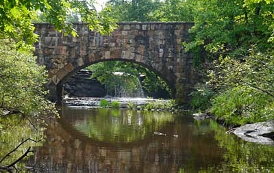
Davies Bridge built by the CCC


That is the story of how the park was named but the rest of the story, as with so many of our nation’s national and state parks, lies with the Civilian Conservation Corps.  The trails, several stone bridges plus most of Petit Jean’s buildings were built by the CCC including the visitor center and the beautiful Mather Lodge, named after Stephen Mather, Arkansas native and first head of the National Park service.


Natural Arch on Seven Hollows Trail

Entering the first 'Hollow' on the Seven Hollows Trail
 
Among the several hikes we took in the park, three were designated National Recreation Trails:  the Cedar Falls Trail, the Cedar Creek Trail and the Seven Hollows Trail.  The trails were lush green following bubbling streams and winding through deep forests.  We loved the verdant beauty and that wonderful green smell.  The geology was also interesting - sandstone formations crisscrossed by fractures which were later filled by quartz crystals or iron deposits.


We made a little excursion outside the park one day.  We just couldn’t help ourselves as there was a wilderness area only a few miles away.  A beautiful drive on a mostly dirt road took us to Pinnacle Point where the view of the surrounding Ouachita Mountains was fantastic.  We then hiked a several miles into the Flatside Wilderness on the Ouachita National Recreation Trail.  The wilderness was so quiet and we didn’t see anyone on the trail, the classic definition of wilderness – a place where people are only visitors.


View from Pinnacle Point

Dayflowers
 
Alas, all was not perfect.  There was one big downside and a couple of smaller ones to all this paradise.  POISON IVY and ticks and chiggers.  Perhaps not lions and tigers and bears but fearsome all the same.  A few of the trails were so overgrown with poison ivy that there was no way to avoid it except to turn back (which we did a few times).  Poor Maya never got to be off lead and her feet and underside got a good washing every day.  So far, no one has broken out in a rash and the ticks and chiggers were found quickly and dealt with. 


Pioneer Cabin


As the week progressed, the humidity and warmer days started to be a factor adding a constant 'glow' to our hikes.  That combined with the poison ivy put a bit of a damper on our hiking mileage but then we had a little more time to read and enjoy the afternoon rains.   All in all, it was a wonderful time and Petit Jean and the Ouachita Mountains were well worth the visit.  
 

Black Rat Snake along the Cedar Creek Trail
As we came along the snake decided to go tree climbing

Snakes climb amazing well


David’s Stats:

Days Hiked:   5
Rain Days:      3  
Total Miles Hiked:   17.88  

Miles of Poison Ivy:  17.53 
Ave. Miles per Day:      3.58
Total Elevation Gain:     2,821
Ave. Elevation Gain per day:   564


Sunday, May 3, 2015

Leaving West Texas -- From Infinity and Beyond!


Inactive oil rigs 'stacked' near my parents' house in Odessa
The oil boom is winding down in West Texas


Back in Odessa we did some packing and house/RV cleaning, changed the oil in the Honda and generally got ready to go. Washing and packing for a long trip is never easy and now that we take seriously long trips, there is always an amazing amount to do.  But a lot of our stuff does stay ‘packed’ in the RV and that certainly helps.
The night before we left, my brother, Tim and his wife Linda, invited us and mom and dad over to their house for a farewell hamburger cookout.  It was a nice evening with lots of visiting going on, dogs and cats playing, good wine and juicy burgers.  With many hugs and a few tears we said goodbye the next morning and made our way to Abilene State Park.  Rain, high winds and tornadoes were all around the area, but we only ran into rain and a little wind.  Spring is not my favorite time to travel ‘tornado alley’ in an RV.


Spring storm clouds near Dallas


One of my cousins, Mary, moved to Abilene a few years ago and I had not seen her since she moved (or for many years before for that matter).  We had a nice time catching up with each other and she fed us the best biscuits and gravy for breakfast that I think I have ever had.  The coffee was pretty darn good too. 

From Abilene we made a quick stop in the Dallas area to get the new tires on our RV aligned.  Because our Mercedes RV chassis is a little wider than most Mercedes vans, not every dealer can align the tires.  The dealer in Grapevine is one of the few in the state that can do the job.  So we were able to check off the last thing on our list we had to do to get the RV road-worthy for our journey. 
 
The 'gang' at Gloria's
Luther and Pat, Richard, Cindy and David, Resa and Chad, Elizabeth and Byrd
plus Maya
 
Being in Dallas gave me a really fun opportunity to see several of the people I used to teach with in the DFW area when I first started teaching after graduate school.  I don’t want to say how many years it has been since I have seen everyone, but it was way too long.  We all met at Gloria’s in Oak Cliff for wonderful afternoon of catching up and telling lies.

When David and I moved to DFW back in 1986 I first worked at Texas Christian University for Luther Smith and then later at Tarrant County College with Richard Doherty.  At Tarrant County and Collin County Colleges, I taught with fellow adjunct professors, Byrd Williams and Chad Smith who is now at Texas A&M Commerce.  All of them are professors at their respective schools and still making photographs.  It was just wonderful to see them and it felt like no time at all had passed.  "Still crazy after all these years..."
 
After a few margaritas things were in much better focus...
 
From Dallas we had one more appointment to make in Texas before we could head for the state line.  David and I both applied to go to school at Stephen F. Austin State University (Lumberjacks) in Nacogdoches, Texas for the fall semester.  So on May 1 we had a ‘transfer student orientation’ to attend.
For those of you who don’t know, we have decided that this summer will be the last portion of our ‘continuous’ three and a half year RV journey.  We will travel this summer but settle in Nacogdoches for a time and try out the college life.  We still plan to be ‘On the Road with Maya’ every summer but we will be taking some classes and exploring the pineywoods and surrounding areas on the weekends. 

The blog will continue this summer and on into the future but the focus will vary between life in Nacogdoches, going to school and traveling on the road.  And who knows, in a few years we may decide to go back on the road full-time again.


Statue on campus of Stephen F. Austin
 a.k.a. 'Surfing Steve'

We enjoyed our orientation (Go Lumberjacks!), learned a little about the university and registered for classes.  David is taking forestry and wildlife management classes and I will take a digital photo class and yoga.  But first things first – vacation.  To Texarkana, the state line and beyond…


Wrapping up our 3rd Year -- On the Road with Maya


Apple blossoms in the White Mountains of New Mexico

Our peaceful week in Ruidoso went by all too quickly.  The spring weather was all over the place with a few days of high winds, some snow and rain and happily towards the end, some really great days. 
Apples used to be a big crop in the Hondo Valley and Ruidoso area.  Over the years apple production has dropped but there are still orchards and many apple trees have been planted in yards all over town.  Even hiking in the mountains we found a few rogue apple trees in full bloom – remnants left from old mountain homesteads. Though we missed out on the cherry blossoms back east, the apple blossoms gave us quite the show.


 April snow in the White Mountain Wilderness, Argentina Cut-Across Trail
 
Finishing off our week in Ruidoso, we took two long hikes in the White Mountain Wilderness.  It was a good way to start getting our legs back into hiking shape and to wrap up our third year ‘on the road.’  Each year as we have been traveling, an unofficial ‘theme’ evolves.  We never really plan them, but the themes ‘crystallize’ as we journey.

Interpretive sign installed after 2012 Little Bear Fire near Ruidoso
We planned to come to Ruidoso in 2012 but had to change our plans as the fire raged.


Besides being about the newness of the RV life and traveling with our dog, Maya, fire and drought in the west became our focus as we headed from Texas to the northwest part of the country.  We didn't leave Texas that year until mid-June, prime fire season, and were continually changing our plans to avoid the many fires and the choking smoke they produced.
The second year we traveled east.  As we followed the Appalachian Trail and listened to all the stories from the hikers we met, the Appalachian Trail became our theme. That was a very special trip for us as we had not spent very much time in the eastern part of our country and didn’t realize just how beautiful the east was.

 
 The marker at the start of the Appalachian Trail, top of Springer Mountain, Georgia


Our third year we went west again, leaving Texas in early April and spending some time in the southern western states before heading north.  Although we hadn’t realized it when we started out, 2014 was the Fiftieth Anniversary of the Wilderness Act.  We discovered this during our time in the Gila Wilderness in New Mexico and decided then to try to hike into as many wilderness areas as we could along our way.  The Pacific Crest Trail became part of our theme, too, as we hiked 13 sections of this Mexico to Canada trail with several of those hikes also being in wilderness areas.


David and Maya on the Pacific Crest 'High Trail' in the Ansel Adams Wilderness,
near Mammoth Lakes, California
 
Now would probably be a good time to sum up some of our thoughts and statistics from this year’s journey, the year of the wilderness.  Everyone wants to know what our favorite places were and that is always so hard to narrow down.  There are so many but I’ll give it a try!
The Bristlecone Pine Forest in the Inyo National Forest of California was a big favorite for both of us.  Those 4,000 year-old plus trees are the definition of ‘gnarly.’ And it is so amazing that they can grow in the bare, white dolomitic soil that surrounds them.

Bristlecone Pine Forest, Patriarch Grove, Inyo National Forest
near Big Pine, California

We also loved the wilderness areas around Mammoth Lakes, the John Muir and Ansel Adams Wildernesses.  Parts of the Pacific Crest Trail went through this region and these were some of our most scenic hikes.  And while in California, it is never a mistake to make a stop at Sequoia National Park or the Redwoods.

Maya near a smaller sequoia tree

Oregon is always a winner and a new place we visited this year was the Sisters area.  Sisters is a picturesque music and art community nestled just east of three mountainous wilderness areas with the Pacific Crest Trail passing through.
We went to some new places in Montana, one of which was the Jewel Basin.  Although not a wilderness, it was a hiking only area and truly one of the most beautiful places we’ve been.  The Rockies in Canada and the Sawtooth Mountains in Idaho finished off our ‘wow’ places for 2014.


Jewel Basin, Montana
 
So after a winter of fun, family and volunteering in Texas, here we are ready to start out on our fourth 'On the Road with Maya' adventure.  It will be fun to see what theme develops this year as we spend time in the Midwest.  This is probably our most ‘loosely’ planned trip yet as we still don’t know much more than we are going to Michigan to visit David’s brother.  But I am confident this journey will eventually have a focus too.  Follow us on the blog as we figure it out.


Maya isn't sure what will happen next...


David’s Stats for 2014: (out of Texas hiking and road mileage)
 
Days Hiked     153
Total Miles Hiked    734
Total Elevation Gain     102,770 feet
Number of Wildernesses Hiked   25

Days hiked on the Pacific Crest Trail   13

Miles driven on the RV   9,740
Miles driven on the Honda   10,560