Sunday, June 28, 2015

On to the 'Yooper' and more 'Plagues'


Beautiful Upper Tahquamenon Falls


A modern marvel of engineering, the 5-mile-long Mackinac Bridge spans the waters between Lake Michigan and Lake Huron (known as the Straits of Mackinac) and connects Michigan’s ‘mitten’ to its Upper Peninsula.  Unless you want to cross by boat, the bridge is the way to go to the Upper Peninsula.   Repairs were being done on the roadway of the bridge as we crossed but that meant we got to go slower and enjoy the views of Lake Michigan on the left and Lake Huron on the right.


View of the Upper Falls from the bottom of the gorge
Observation platform for the brink of the falls is in the upper right corner of photo
 

Our first destination in the U.P. or ‘Yooper’ as many call it was Tahquamenon Falls State Park.  Besides being famous for the gorgeous amber-colored river and falls, the state park contains over 48,000 acres of wilderness.  The golden-brown color is caused by tannins originating from the decomposing vegetation found in the cedar, hemlock and spruce forests in the river's drainage basin.  Because of the color some people have nicknamed the waterfalls, 'Rootbeer' Falls.  I also suspect it is easier to say.  It took me a few days to get it down, but Tahquamenon rhymes with phenomenon.


View of Upper Falls from the platform at the brink
 

The Upper Falls is the main attraction at 200 feet wide with a single 50-foot drop.  In volume it is the second largest waterfall east of the Mississippi River, Niagara Falls being the largest.  But enough of the facts, it was simply beautiful.  Walking down the stairway to the brink rewarded us with the spray of the falls in our faces and the feel of the thundering water through the wooden platform.


Heading out for a hike

Maya could use a 'full body' net for the mosquitoes, but having long hair helps
 
We camped at Hemlock Campground about 4 miles downriver from the Upper Falls near the smaller cascades and waterfalls known as the Lower Falls.  The campground was shady with mature pine, cedar, maple and birch and a nearby swamp.  This did not bode well for insects.  Mosquitoes were, well let’s just be honest, horrible.  We did not sit out and enjoy the evenings – although fire smoke can be helpful in keeping insects away, it wasn’t enough.  Not even Deep Woods OFF helped for long.


Not really that funny...
 
During the day the mosquitoes were not as bad and keeping a brisk pace on the trail helped.  So with wearing our head nets we didn’t suffer too much while we were walking.  But it was fighting our way through the swarms every time we went in and out of the RV while trying not to let too many inside that really got old.  We had DEET but a cloud would still manage to get in the RV whenever we had to go in or out.  Then we had the fun task of trying to kill the mosquitoes that did get in so we wouldn’t get chewed up all night long. 
 

Maya taking refuge in the shower, poor puppy
 
Maya quickly got tired of all the swatting and took to hiding in the shower every time we started murdering mosquitoes.  David and I had competitions for the most kills.  He definitely won but when bitten I could be pretty lethal and I’m not proud to say, my language suffered considerably.  For two days we had not only mosquitoes but some very small fly-like things that gave us both huge swollen knots wherever they got us.  We were sure glad they did not last long!


Lighthouse, Coastguard Station and Shipwreck Museum grounds at Whitefish Bay
The wreck of the Edmund Fitzgerald is several miles off shore.
 
It wasn’t all a massacre though. We survived 4 days, hiking parts of all of them and had our first experiences of Lake Superior.  What a lake -- 10 percent of all the fresh water in the world is in Lake Superior!  We also took two short trips, one to Whitefish Bay seeing the Lighthouse and Shipwreck Museum grounds and another to visit Crispin Point Lighthouse.  Add to that two good hikes on the North Country Trail, one with mosquitoes and one mostly without, and we can say on the whole it was a good time. 


Crispin Point Lighthouse on Lake Superior, restored in the 1990s


Part of the North Country Trail travels between the Upper and Lower Falls mostly following the Tahquamenon River through dense forests of both trees and ferns.  The day we hiked this section was sunny, dry and breezy so the mosquitoes were at a minimum.  Afterwards we had a nice lunch at the Tahquamenon Falls Brewery and Restaurant, a privately-owned establishment in the park that might be as well-known as the falls.  The good definitely outweighed the bad.


Wild Iris blooming on the banks of the Tahquamenon River
 

David’s Stats:

Days Hiked:  4  
Total Miles Hiked:  16.54     
Ave. Miles per Day:    4.14 
Total Elevation Gain:    1,236
Ave. Elevation Gain per day:   309


Lower Tahquamenon Falls from the North Country Trail

Fern with yellow wildflower peaking through
Along the North Country Trail

Clark Lake, a remote inland lake in the wilderness of Tahquamenon

Many of the Upper Peninsula trees and plants were just now budding out
 

Friday, June 26, 2015

To the top of the 'Mitten' and the North Country Trail


Red pine forest with fern in Wilderness State Park


Wilderness State Park located west of Mackinaw City, is truly on the tip of Michigan’ mitten.  We spent 3 nights and hiked 2 days in this beautiful park, our last stop before crossing the Mackinac Bridge into the wilds of the Michigan Upper Peninsula (U.P.).


Lady Slipper Orchid
Many wildflowers were in bloom
 
Besides wanting to spend a little more time on Lake Michigan, one of the main reasons for visiting Wilderness State Park was the chance to hike on the 4,600-mile North Country National Scenic Trail.  Unlike the Appalachian, Pacific Crest (both we have hiked in the last two years) and the Continental Divide National Scenic Trails, the North Country National Scenic Trail does not follow major mountain ranges extending north to south.  Instead the North Country Trail (NCT) journeys mainly east to west following a variety of environments from New York’s Adirondack Mountains through Pennsylvania, Ohio, Michigan, along the shores of the Great Lakes through Wisconsin, Minnesota and finally ending in the vast plains of North Dakota.


Insect head nets came in handy


We had thought we would hike on the North Country Trail earlier when we were in Ohio, but rainy weather, poison ivy, ticks and muddy trail conditions made us change our minds.  However lately, as you may have noticed since I haven’t been complaining as much, we seem to have escaped some of those previous ‘plagues.’   At any rate, we were excited to finally get on the NCT.

Our first day we hiked parts of the Red Pine, East Ridge, Hemlock and Wilkenns trails plus a short section of the North Country Trail to make about a 6-mile loop.  This ‘sampling’ of trails showed off the beauty and diversity of Wilderness State Park. 


Beach grasses on 'youngest' dunes nearest the lake shore

Tiger swallowtails on the beach
 
The next day we hiked exclusively on the NCT through the dune and swale complexes, also called linear or parabolic dunes, near the shoreline of Lake Michigan.  The dune – swale communities are significant for their high concentration of biodiversity in a small area.  As we hiked up and down the dunes they increased in size the farther away we went from the lake.  It was so interesting to see and hike the dunes and swales from the lowest and youngest near the lake to the oldest ones farther inland. 


Shadier section of the North Country Trail in the older dune complex


The youngest dunes are colonized by beach grass and are prime nesting areas for the endangered Piping Plover.  Then as we moved inland a variety of grasses, ferns and sedges became dominant.  On the secondary dune ridges which are between 55 – 200 years old there are low growing evergreen shrubs, sand cherry and bunch grasses.  The tallest and oldest dune ridges are between 200 and 3200 years old.  Mixed pine forests dominate with white pine, red pine, white spruce, balsam fir, white cedar and paper birch being common.  Thank goodness much of the trail went through the oldest dunes and shade was abundant.  All that up and down was a bit of a workout!


Columbines

Bunchberry
 

All in all we had a wonderful time exploring Wilderness State Park.  The campground was very close to the lake and watching sunsets on Lake Michigan was on the agenda every night.  There was one problem though that we are hoping against hope won’t become our 'fourth plague.'  The mosquitoes were definitely increasing in numbers, so much so that we had to break out the head nets for our hikes.  It wasn’t that bad as long as we kept moving, but stopping for very long was not a good idea.  We are a little worried as we’ve heard some scary stories about Michigan insects in the U.P. – our next destination.

 
A blue blaze marks the North Country Trail

David’s Stats:

Days Hiked:   2    
Total Miles Hiked:  12.73   
Ave. Miles per Day:   6.37  
Total Elevation Gain:     1,409
Ave. Elevation Gain per day:  705


Sunday, June 21, 2015

Sleeping Bear, Hiding Lake


Large dune in fog on the shore of Lake Michigan 
at Sleeping Bear Dune National Lakeshore


Anishinaabek Indian legend has it that long ago, in the land that is now Wisconsin, a mother bear and her two cubs plunged into Lake Michigan to avoid a raging forest fire.  As they swam and swam, the cubs became tired and lagged far behind.  Mother bear finally reached the opposite shore in Michigan and climbed to the top of a bluff to watch and wait for her cubs.  But the cubs didn’t make it.  Today “Sleeping Bear,” a solitary dune over-looking Lake Michigan, marks the spot where mother bear waited.  Her lost cubs are the two Manitou islands just off shore.

Crazy people crawling up the really steep dune in the fog
 
This American Indian story may have been the first explanation of how the large sand dunes and other features of the land near Sleeping Bear were created.  In more recent times scientists have followed geologic clues to explain the complex landscape.  First, shallow warm seas covered the area followed by the powerful earth-moving forces of glaciers, wind and water.  Glaciers left behind a sandy coast on the windward side of Lake Michigan and the prevailing westerly winds and lake waters did the rest.
 
Basswood tree struggling to keep rooted in the ever-shifting sands
 
Much of the land around the Great Lakes has this ‘dune and swale’ landscape formation of beach dunes with narrow swales separating the dunes.  The swales are wetlands containing pools with grasses, sedges and ferns.  This is ideal habitat for migrating and nesting birds. 

Sleeping Bear Dunes National Lakeshore, managed by the National Park Service, has some of the largest dunes in the Great Lakes.  The park’s namesake, Sleeping Bear Dune, is actually a glacially formed bluff topped by sand that towers over 400 feet above Lake Michigan.
 
Young and old alike enjoy the 'Dune Climb' in their own way
 
We learned all this cool stuff on the Pierce Stocking Scenic Drive that we took our first afternoon in the park.  It was still cloudy and foggy with visibility only about half a mile or less so Sleeping Bear Dune and Lake Michigan were nowhere to be seen.  But we could learn about them, imagine what they would look like and see some of the other sites on the scenic drive.  One spot in the Sleeping Bear Complex of dunes, the Dune Climb, was easily accessible so we could see all the people climbing that dune.
 
Lake Michigan with Sleeping Bear Dune in the distance
Sun makes all the difference!
 
The next morning David came in from his early walk with Maya and woke me with the news that the sun was out.  We quickly had breakfast, fixed a lunch to put in our packs and headed out for a hike to Lake Michigan.  It was a glorious day – crisp, clear and cool.  We hiked through shady beech-maple forests to the open, sunny dunes and yes, a view of deep blue Lake Michigan with Sleeping Bear Dune in the distance.  I guess there is nothing like a few days of damp foggy weather to make a clear sunny day seem even more beautiful.


Lake Michigan in fog


Same place, next day -- what a difference!


We have one last stop to make on the shores of Lake Michigan at Wilderness State Park on the very tip of the ‘mitten.’  A few days in this park near Mackinaw City and then it is on to the U.P. or Upper Peninsula to spend a couple of weeks.


Dune erosion at work
Pyramid Point


David’s Stats:

Days Hiked:  1  
Total Miles Hiked:   5.64  
Total Elevation Gain:  967  


Saturday, June 20, 2015

West: To the other side of the 'Mitten'


Lake Michigan?


Leaving Lake Huron, we traveled west across the state to spend several days on the Lake Michigan side of the ‘mitten’ before heading to the upper peninsula.  We stopped at Orchard Beach State Park just a few miles north of Manistee to spend the night.  It was a gray and foggy day and there was no view to be had of Lake Michigan.  People said there was a lake across from our campsite but we didn’t believe it.
 
Downtown Manistee
 
After getting ourselves settled in the park and having a look for the lake that wasn’t there, we decided to drive back a few miles to the cute little town of Manistee and have a look around.  Maybe we would be able to see the lake from there.  As we approached the downtown area there was still no lake view but we noticed that a car show was being held on River Street.  Well at least we could look at downtown and cars.


Manistee Car Show on River Street

Maya checks out the car show and finds a friend


It was actually a good show with quite the variety of vintage and antique cars and trucks.  Lots of people were enjoying themselves listening to classic 50’s and 60’s music and checking out the cool cars.  We got into the spirit of things ourselves and were glad we made the trip into town.


Back at the campsite the fog was still there, maybe worse.  We had a good sleep and bright and early the next morning, there was still no lake to be seen.  So, we hiked Orchard Beach’s nature trail and were reminded of our fifth grade geography/geology lessons on glaciers and how the Great Lakes were formed.  Lake Michigan, like the rest of the Great Lakes, was not always a lake.  Before the Ice Age, the Great Lakes were stream valleys.  It was only after the Ice Age, once the glaciers had sculpted the region into much of its present shape, that the lake basins were filled with water from the melting glaciers.
 

View of a meadow from the Orchard Beach Nature Trail


Meadow wildflowers


Following our hike, we struck camp and drove about 60 miles north to Sleeping Bear Dunes National Lakeshore to spend a couple more nights on the shores of Lake Michigan.  Maybe there we would get a glimpse of the illusive lake…


David’s Stats:

Days Hiked:  1        
Total Miles Hiked:   0.94  
Total Elevation Gain:   83 


Tuesday, June 16, 2015

Tip of the 'Thumb' and up the Mitten


Sand dunes, grasses and native flowers along the shores of Lake Huron


The main part of Michigan is shaped like a mitten and Detroit is located more or less at the base of the thumb.  We decided that the next destination in our ‘survey’ of Michigan would be Port Crescent State Park on Lake Huron at the very tip of the thumb.  Then we would take a little jaunt up the inside of the mitten to Tawas Point State Park before heading west to the Lake Michigan side of the state.
We arrived at Port Crescent State Park in the early afternoon after a rainy but nice drive.  Much of the thumb was originally forested but now it is nearly all farmland and we passed through field after field of newly planted corn, grains and vegetables.  Along the coast of Lake Huron and around the state park the land is still a mix of hardwood and pine forests with sand dunes covered in grasses near the lake.


Picnic of smoked ribs
Maya hopes for a bone
 
By the time we found a campsite and set up, the rain had cleared and we were starving.  Fortunately, Jim had sent a care-package of his smoked ribs along with us and we had a delicious picnic lunch with very little effort on our part.  We spent the remainder of the afternoon and evening enjoying the improving weather and strolling along the lake.
The next day dawned bright and clear and we seized the moment by heading out on a nature trail.  From dunes with beach grasses and jack pines to wetlands to forests we learned about the different ecosystems in the park and experienced the rolling dunes and swales of the terrain.  By afternoon the rain had moved back in so we were really glad we had gotten our hike in early.


Maya cools off in Lake Huron after our nature hike


Next we headed to Tawas Point which was only about 50 miles across Lake Huron but since we couldn’t fly across, we had to drive about 120 miles down the thumb and then back up the mitten.  It took us closer to 3 hours and of course it was raining so that slowed us down too.
 
Tawas Point Lighthouse
 
We were going to stay in the state park but there was a big crowd because of the upcoming Tawas Point Celebration Days and with all the rain we opted for a commercial campground nearby.  As it turned out we were very glad we stayed two days at Tawas RV Park.  Usually I am not all that excited about commercial campgrounds, but this was a very quiet, secluded and friendly place. 

Thanks to Maya we met almost everyone and their dog (pretty much everyone had a dog).  Many of the people at the campground were ‘seasonal campers.’  Most lived in Michigan and spent their summers at the park.  A few were from other states, the farthest away being Florida. We were invited to the group campfire and received many suggestions on where we should visit in Michigan. 


Civil War re-enactor at Tawas Point Celebration Days
 

The next day we visited the Tawas Point Lighthouse for the ‘Celebration Days.’  There were re-enactors in costume, demonstrations and food.  We visited the lighthouse, walked along the point and ate of course.  It was a foggy, cloudy day thus not as picturesque as it could have been, but we didn’t get rained on. 
After a nice night in our RV park, we said goodbye to our newly-met friends with wishes for safe travels and invitations to return and spend the summer.  We were ready to continue on our journey this season, but it was a good feeling to be 'at home' for a few days among such nice people.


Beach Pea, a native dune plant that helps control dune erosion


David’s Stats:

Days Hiked:  3
Rain Days:    2    
Total Miles Hiked:   10.56  
Ave. Miles per Day:      3.52
Total Elevation Gain:     593
Ave. Elevation Gain per day:   198 


Saturday, June 13, 2015

Visiting Jim and family...


Swans and babies in the Huron River at Proud Lake State Recreation Area


David’s brother lives in a western suburb of Detroit within about 15 minutes of Proud Lake State Recreation Area.  That worked out great for us – we got to stay in a beautiful state park away from traffic and noise and yet still be close to Jim and his wife Harumi.  We’ve all been having a great time talking, eating good food and site-seeing so I’m a bit behind on the blogging.  What follows is a summary of some of the highlights of our visit.


Wetland area at Proud Lake
 

Saturday was our first full day in the Detroit area and Jim brought Harumi and her soon to be 14-year-old daughter, Shiori, out to Proud Lake for a hike.  The ‘girls’ wanted to try some hiking and as David, Maya and I are always ready for a walk in the woods – it was the perfect opportunity to introduce them to one of our favorite things. Jim’s knees are not quite up to hiking these days, so he stayed behind at the RV with a good book and the rest of us hit the trail.

 
We watched a turtle lay eggs near our campsite


Covering the eggs
We told the park staff about it and they put up a little fence to protect the nest


There are over 20 miles of trails at Proud Lake with an amazing diversity of terrain including two lakes, a river, a marsh, forests, fields and wetlands.  On our hike we circled the marsh, wound through woodlands and paralleled the Huron River to a beautiful swimming spot.  Only Maya went for a swim as it was a cool morning and the water temperature was still too chilly for us.  It was our first time to meet Shiori and only our second time with Harumi so we all enjoyed getting to know each other better on our most excellent hike.

That afternoon Jim took all of us to his favorite neighborhood Mexican food restaurant where we ate a late lunch.  Harumi’s son, Takuya, came along and we had a nice meal with Jim’s new family.

 
Takuya, Jim, Harumi and Shiori
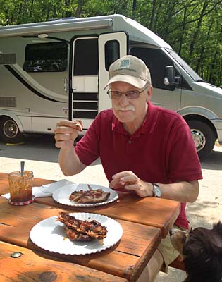
 
Sunday was a good day for hanging out at Jim and Harumi’s apartment.  Jim spent 5 hours smoking ribs while David did the laundry.  The three of us girls went out for a little shopping while the guys did most of the work – as it should be. 

We also got to see Tama, Jim’s cat that we gave him several years ago.  My friend Jose found Tama as a small kitten hanging out in the trash dumpster at a Mexican restaurant in San Antonio.  Tama stayed with us at our house for a few days and we thought about keeping him but we gave him to Jim that Christmas.  Then the little guy gave us ringworm -- a memorable Christmas to say the least. Poor kitty, it wasn't his fault.  We were glad to see Tama again after all this time and see that he has made the adjustments from a street kitten in San Antonio to a bachelor pad in Ft. Worth to a happy family in Michigan.  He’s one lucky kitty.
 
 
Tama relaxing with Jim

 
Monday was a school and work day for everybody but us ‘retirees’ and we took the opportunity to do some sight-seeing around Detroit.  You hear and see so much on TV of the effects of the economic downturn on Detroit and we did see some of that as Jim showed us around.  But all in all we thought downtown Detroit looked pretty good and like things were getting better.  And being spring, everything was so green and beautiful, even the empty lots where houses had once been.

 
Detroit skyline from Belle Isle looking across the Detroit River


Church near downtown


Tuesday David and I spent the morning doing some more hiking around Proud Lake.  The trails were excellent and the insects and poison ivy were minimal so we wanted to enjoy that.  Those conditions have been hard to come by this spring!  After a fine morning enjoying the trails we met Jim and Harumi for a late lunch. The lunch at Indo-Fusion was delicious and spicy, a Portuguese Indian mix of mostly curries.  We were glad we ordered it ‘medium’ and not ‘hot.’


A chicken and vegetable curry -- as good as it looks...
 

The rest of the afternoon flew by and then David and I said our goodbyes as we planned to leave out the next morning for the 'thumb' of Michigan.  It was such a nice visit and we didn’t want to wear out our welcome.  After all, we do hope to be invited back again.
 

David’s Stats:
Days Hiked:  2  
Total Miles Hiked:  7.79   
Ave. Miles per Day:    3.90 
Total Elevation Gain:    174
Ave. Elevation Gain per day:   87 


Tama