 |
| Beautiful Upper Tahquamenon Falls |
A modern marvel of engineering, the 5-mile-long Mackinac
Bridge spans the waters between Lake Michigan and Lake Huron (known as the
Straits of Mackinac) and connects Michigan’s ‘mitten’ to its Upper Peninsula. Unless you want to cross by boat, the bridge is the way to go to the Upper Peninsula. Repairs
were being done on the roadway of the bridge as we crossed but that meant we
got to go slower and enjoy the views of Lake Michigan on the left and Lake
Huron on the right.
 |
View of the Upper Falls from the bottom of the gorge
Observation platform for the brink of the falls is in the upper right corner of photo |
Our first destination in the U.P. or ‘Yooper’ as many call
it was Tahquamenon Falls State Park.
Besides being famous for the gorgeous amber-colored river and falls, the
state park contains over 48,000 acres of wilderness. The golden-brown color is caused by tannins originating from the decomposing vegetation found in the cedar, hemlock and spruce forests in the river's drainage basin. Because of the color some people
have nicknamed the waterfalls, 'Rootbeer' Falls.
I also suspect it is easier to say.
It took me a few days to get it down, but Tahquamenon rhymes with
phenomenon.
 |
| View of Upper Falls from the platform at the brink |
The Upper Falls is the main attraction at 200 feet wide with
a single 50-foot drop. In volume it is
the second largest waterfall east of the Mississippi River, Niagara Falls being
the largest. But enough of the facts, it
was simply beautiful. Walking down the
stairway to the brink rewarded us with the spray of the falls in
our faces and the feel of the thundering water through the wooden platform.
 |
| Heading out for a hike |
 |
| Maya could use a 'full body' net for the mosquitoes, but having long hair helps |
We camped at Hemlock Campground about 4 miles downriver from
the Upper Falls near the smaller cascades and waterfalls known as the Lower
Falls. The campground was shady with
mature pine, cedar, maple and birch and a nearby swamp. This did not bode well for insects. Mosquitoes were, well let’s just be honest,
horrible. We did not sit out and enjoy
the evenings – although fire smoke can be helpful in keeping insects away, it
wasn’t enough. Not even Deep Woods OFF
helped for long.
 |
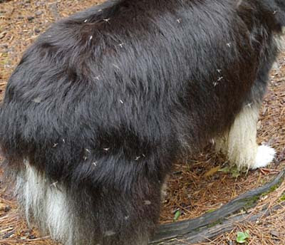
| Not really that funny... |
During the day the mosquitoes were not as bad and keeping
a brisk pace on the trail helped. So
with wearing our head nets we didn’t suffer too much while we were walking. But it was fighting our way through the
swarms every time we went in and out of the RV while trying not to let too many
inside that really got old. We had DEET
but a cloud would still manage to get in the RV whenever we had to go in or
out. Then we had the fun task of trying
to kill the mosquitoes that did get in so we wouldn’t get chewed up all night
long.
 |
| Maya taking refuge in the shower, poor puppy |
Maya quickly got tired of all the swatting and took to
hiding in the shower every time we started murdering mosquitoes. David and I had competitions for the most
kills. He definitely won but when bitten
I could be pretty lethal and I’m not proud to say, my language suffered
considerably. For two days we had not
only mosquitoes but some very small fly-like things that gave us both huge
swollen knots wherever they got us. We
were sure glad they did not last long!
 |
Lighthouse, Coastguard Station and Shipwreck Museum grounds at Whitefish Bay
The wreck of the Edmund Fitzgerald is several miles off shore. |
It wasn’t all a massacre though. We survived 4 days, hiking parts of all of them and had our first experiences of Lake Superior. What a lake -- 10 percent of all the fresh water in the world is in Lake Superior! We also took two short trips, one to Whitefish Bay seeing the Lighthouse and Shipwreck Museum grounds and another to visit Crispin Point Lighthouse. Add to that two good hikes on the North
Country Trail, one with mosquitoes and one mostly without, and we can say on the whole it was a good time.
 |
| Crispin Point Lighthouse on Lake Superior, restored in the 1990s |
Part of the North Country Trail travels
between the Upper and Lower Falls mostly following the Tahquamenon River
through dense forests of both trees and ferns.
The day we hiked this section was sunny, dry and breezy so the
mosquitoes were at a minimum. Afterwards
we had a nice lunch at the Tahquamenon Falls Brewery and Restaurant, a
privately-owned establishment in the park that might be as well-known as the
falls. The good definitely outweighed the bad.
 |
| Wild Iris blooming on the banks of the Tahquamenon River |
David’s Stats:
Days
Hiked: 4
Total Miles Hiked: 16.54
Ave. Miles per Day: 4.14
Total Elevation Gain: 1,236
Ave. Elevation Gain per day: 309
 |
| Lower Tahquamenon Falls from the North Country Trail |
 |
Fern with yellow wildflower peaking through
Along the North Country Trail |
 |
| Clark Lake, a remote inland lake in the wilderness of Tahquamenon |
 |
| Many of the Upper Peninsula trees and plants were just now budding out |


No comments:
Post a Comment