 |
| Sand dunes, grasses and native flowers along the shores of Lake Huron |
The main part of Michigan is shaped like a mitten and
Detroit is located more or less at the base of the thumb. We decided that the next destination in our
‘survey’ of Michigan would be Port Crescent State Park on Lake Huron at the
very tip of the thumb. Then we would
take a little jaunt up the inside of the mitten to Tawas Point State Park before
heading west to the Lake Michigan side of the state.
We arrived at Port Crescent State Park in the early
afternoon after a rainy but nice drive.
Much of the thumb was originally forested but now it is nearly all
farmland and we passed through field after field of newly planted corn, grains
and vegetables. Along the coast of Lake
Huron and around the state park the land is still a mix of hardwood and pine
forests with sand dunes covered in grasses near the lake.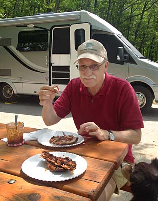 |
| Picnic of smoked ribs Maya hopes for a bone |
By the time we found a campsite and set up, the rain had
cleared and we were starving.
Fortunately, Jim had sent a care-package of his smoked ribs along with
us and we had a delicious picnic lunch with very little effort on our
part. We spent the remainder of the
afternoon and evening enjoying the improving weather and strolling along the
lake.
The next day dawned bright and clear and we seized the
moment by heading out on a nature trail.
From dunes with beach grasses and jack pines to wetlands to forests we
learned about the different ecosystems in the park and experienced the rolling
dunes and swales of the terrain. By
afternoon the rain had moved back in so we were really glad we had gotten our
hike in early. |
| Maya cools off in Lake Huron after our nature hike |
Next we headed to Tawas Point which was only about 50
miles across Lake Huron but since we couldn’t fly across, we had to drive about
120 miles down the thumb and then back up the mitten. It took us closer to 3 hours and of course it
was raining so that slowed us down too.
 |
| Tawas Point Lighthouse |
Thanks to Maya we met almost everyone and their dog (pretty much everyone had a dog). Many of the people at the campground were ‘seasonal campers.’ Most lived in Michigan and spent their summers at the park. A few were from other states, the farthest away being Florida. We were invited to the group campfire and received many suggestions on where we should visit in Michigan.
 |
| Civil War re-enactor at Tawas Point Celebration Days |
The next day we visited the Tawas Point Lighthouse for
the ‘Celebration Days.’ There were
re-enactors in costume, demonstrations and food. We visited the lighthouse, walked along the
point and ate of course. It was a foggy,
cloudy day thus not as picturesque as it could have been, but we didn’t get
rained on.
After a nice night in our RV park, we said goodbye to our
newly-met friends with wishes for safe travels and invitations to return and
spend the summer. We were ready to
continue on our journey this season, but it was a good feeling to be 'at home' for a few
days among such nice people.  |
| Beach Pea, a native dune plant that helps control dune erosion |
David’s Stats:
Days
Hiked: 3
Rain
Days: 2 Total Miles Hiked: 10.56
Ave. Miles per Day: 3.52
Total Elevation Gain: 593
Ave. Elevation Gain per day: 198
No comments:
Post a Comment