Thursday, January 17, 2019

Here we go again - Another New Year


The twin peaks near Alpine shrouded in freezing fog


Our little house and the results of freezing fog


My goodness, the years keep a coming!  And that’s a good thing.  Just wish those years weren’t coming so quickly.  I’m a big believer in the theory of relativity these days.  Time just isn’t consistent anymore – it seems to be speeding up like crazy…  Well, enough of my yammering, I’ll catch you up on our life in West Texas for the past few months before we welcome in the New Year.


The last few months of 2018 were very busy ones for David and me.  After returning to Texas in August from our travels, my mom and dad both celebrated their 85th birthdays.  Mom’s birthday was in late August and dad’s in November.  We threw birthday parties for both of them with lots of friends and family.  Mom’s birthday fell on a Sunday, so she got two parties, one at church at one at home later that day.  Dad’s was a few days before Thanksgiving, so his party went on for almost a week.  It was so nice to celebrate the 85 years of their lives with the both of them!


Two pretty good looking 85 year-olds!


Between the two birthdays, David and I took a trip to Big Bend at the end of September for the 40th Anniversary of the Wild & Scenic Rivers Act of 1978.  We took Silver and camped in Rio Grande Village.  It was still mighty warm in Big Bend at the end of September.  Even so, we managed a few hikes and went to talks about the Rio Grande River and the ongoing research being conducted by Sul Ross State University.  At the end of each day we were glad we had electricity and could cool off in the RV.

A wild and scenic Rio Grande River near Rio Grande Village


In 1979, just a year after the Wild & Scenic Rivers Act was enacted and to celebrate the Rio Grande’s inclusion, David and I, plus David’s brother and three other friends took a canoe trip down the Rio Grande.  We put in at Rio Grande Village near the head of Boquillas Canyon and paddled all the way to Langtry, TX, some 185 miles by river.  We still talk about that float trip. 


The Sierra del Carmens from Rio Grande Village
These mountains are part of the same formation as the walls of Boquillas Canyon

Dr. Kevin Urbanscyzk with the Rio Grande Research Center at Sul Ross 
State University gave a talk and demo on how the Center helps
 to document invasive species that threaten the river.


It was quite the adventure, following a 14-foot rise on the Rio Grande.  After torrential rains, we were the first people issued permits on the river that very hot July of 1979.  Once we entered the steep and narrow mouth of Boquillas Canyon, we were in solid canyon walls of up to 1500 feet for nearly 2 days with another 3 to 4 days inside the long, uninterrupted lower canyons ahead of us.  So it was paddle out or climb out the canyon walls -- no cell phones in 1979 and no help available if we were to have a problem.  

A hike on the Window Trail in the Chisos Mountain Basin

A rainy late summer in the Big Bend made for a lot of water on the Window Trail


I won’t go into the whole story, but we did have a few problems – from very fast running water and almost wrapping the canoe around a rock in the first hours of the trip, drowning most of the cameras in that little accident, to 115 degree days, severe sunburn, the Rio Grande running the consistency and color of chocolate milk and having to drink that water, to rescuing a very young filly from being stuck in the mud, putting her in the canoe and paddling down river  so we could actually get her back up on the bank and out of the mud, fighting 50-plus mph winds and 4-5 ft. waves going up stream on the river and last but not least (certainly not to David) a most severe case of poison ivy!  But we were young – it was a blast…  Wild & Scenic Rivers Rock!

Beautiful late afternoon sky from our campsite in Rio Grande Village


We also managed to take classes at Sul Ross during the fall semester.  Both of us took Archaeology of the Southwest which was a really informative class of places we had previously visited in our travels and of the Big Bend area.  We will have to go back and visit the Four Corners area so we can appreciate the history of that place with more knowledge this time.  Also, I never knew there were so many Late Archaic and Paleoindian sites in the Big Bend.  We hope to be able to go on some local archaeological digs before too much longer. 

Looking out "The Window"  
Always a treat!

The dessert is a marvelous place to explore


I also took a watercolor class.  It was quite a challenge for me and very time consuming.  There is a good reason I’m a photographer. I’ve a long, long way to go just yet, but I did really enjoy the class and think I will continue to play around with watercolor. 

We had visitors, friends from when I worked at the Botanical Gardens in San Antonio, with us for a few days in late November.  Terril and Lubos were volunteers at the Garden and we all became good friends.  They have since moved to Portugal and we hadn’t seen them in almost 3 years.  It was great catching up and there may be a trip to Portugal in our future.  

Christmas Dinner


Our Christmas was spent with my parents and my brother and sister-in-law and her mother.  Most family had come earlier for the birthday celebrations, so Christmas was a small affair.  But maybe one of our best – easy and relaxing, enjoying each other and thankful for our blessings and the gift of Christmas.

Kitties love Christmas!


After Christmas, our good friend, Chad was out for a few days.  We had some crazy weather with freezing fog which we had never had experienced before.  The freezing fog was just about the prettiest thing I’ve seen in a while.  We had no rain or snow, just very cold weather and a fog that rolled in.  The trees and cactus didn’t ice up but had these amazing fairy crystals all over them.  Truly beautiful!


Amazing crystals of ice on the trees


Well, that takes us into 2019!  Here we go again.  No resolutions this year, just to live and take it all in as it comes – even the yucky stuff.  Really, no choice there but here’s hoping for more good stuff than bad for us all.  (And maybe for the government to open back up?)  Would that be too much to ask?

Hopefully the spider was long gone


Tuesday, August 7, 2018

Back to Texas - Baseball and a High Point


High Point,  Davis Mountains State Park


All I can say is it certainly was hot when we got back to Texas.  Odessa was in the 100s but when we got back to Alpine, things had cooled down to the low and mid-90s.  The mountain towns, Alpine, Ft. Davis and Marfa typically manage to stay about 5 to 10 degrees cooler than the surrounding areas.  It may not seem like much, but those degrees can make a difference especially when there are evening breezes.  Though it has been much warmer than the mountains of Colorado and New Mexico, we are adjusting and even participating in outdoor activities.


Go Cowboys!


The Alpine Cowboys baseball team is in the playoffs!  We went to our first Cowboy game a few nights ago with some friends and really enjoyed the game and the weather.  The Cowboys won but it was a close and exciting game.  The weather got into the spirit of things, cooling into the 70s by 8 pm with a very steady breeze that almost made me want a light sweater (well, ok, that is stretching it a little).

On the trail to High Point

Sunday, we went for a High Point Hike at Davis Mountains State Park.  Supposedly Saturday was “Summit Day” encouraging people to climb something so when we saw that the local Master Naturalist chapter was offering a High Point Hike at the state park, we were all in.

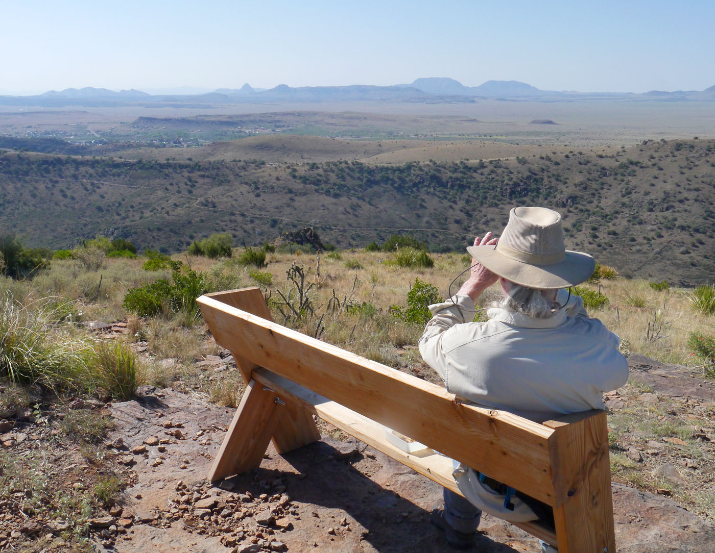
Views from half way up the trail


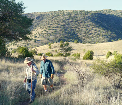
The hike started early so we had to get up and drive 30 miles to be at the state park by 7 am.  David and I hadn’t been getting up much earlier than 7 so we were surprised at how cool many summer mornings can be here.  We dressed for the heat and both of us stayed a little cool for the first hour or so of the hike.  But of course, we knew that would not last.  Still it was such a pleasant morning and the mountains shaded us during most of the hike to the high point.  At the start of the hike, the trail descended a little so that we hit the park’s lowest point of elevation.  After that it was a steady climb to the high point in the park at almost 1000 feet higher.

Skeleton Flower

We made it! High Point at Davis Mountains State Park.


The breeze on High Point was great and our group of 9 hikers plus the two park rangers enjoyed a snack and some stories on top.  Tyler, the interpretive ranger, had some interesting stories of early ranching days in the area which we all enjoyed.  We learned of the legend of Delores Mountain which I’ll share one of these days when David and I hike up Delores Mountain.  You will have to wait for a little cooler weather though.

Master Naturalist, Steve, is the first to sign the register
that we placed on the high point.  Other hikers can now
enter their names in the book, but we were first!


I’ll have to say going down was not quite as fun because we were not in the shade of the mountain anymore and the morning breezes faded to nada.  Exposed on the southern slope, it was hot going down.  Also, how come the trail never seems quite as rocky when you are going up?  We felt those rocks rolling under our feet and had to watch the trail carefully not to stumble.

Joe and Steve heading up towards High Point. 
This is one of the gentler sections of the trail.


Though not the elevation gains of some of the hikes we did on our recent trip to Colorado and New Mexico, High Point was challenging because of the heat and rockiness of the trail.  Also, it was almost 9 miles, so we had a workout right here in our own backyard.  We will be checking out other hikes in our area but maybe not until it is just a little cooler.

Ranger Tyler Priest explains what that white stuff in the creek bed is.
Can you believe, dried algae?  The creek was flowing not too long ago.


In the last week we have unpacked and settled back in.  Silver is cleaned up and ready for some fall and winter camping before too long.  So, I’ll plan to keep adding some blog entries this fall and winter.  We should be checking out lots of great places in the Big Bend area over the next six months or so.  Then we will have to see what happens.  Someday in the next few years, we may go back on the road again full time.  But in the meantime we will stay fairly close to home, adventuring where we are.

This bunch of sticks in the walking stick cholla is a cactus wren nest.


David’s Stats:

Days Hiked  1
Total Miles Hiked    8.5   

Total Elevation Gain     1,050


High Point View


Friday, July 27, 2018

The Ends of Windsor - Maya Remembered


At the beginning of our trip this summer we had planned to take at least one memorial hike into the Pecos Wilderness near Santa Fe to honor Maya.  We wanted to leave some of her ashes in places we all loved and walked together many times.  But dry conditions and hot weather had caused the Santa Fe and Carson National Forests to be closed so we postponed our memorial hoping the rains would come and forests would be open on our way back.  Luckily that did happen, and we were able to honor Maya this week with three hikes.

Columbine-Hondo Wilderness 2018

Maya in 2016


Our first hike was near Red River, NM on our way to Santa Fe.  We spent a couple of nights in the Carson National Forest at one of our favorite camping spots, Columbine Campground.  The trailhead at the end of the campground leads into the Columbine-Hondo Wilderness and we walked for about 8 miles into the wilderness on a trail we had taken with Maya many times before.  The flowers and plants were wet with rains from the night before and everything smelled fresh and sweet. We left some of Maya’s ashes in a meadow near the Columbine River where we all used to stop and eat lunch.  For Maya, eating lunch was always one of the best parts of taking a hike. 

Coneflower and butterfly in meadow near Columbine River


But the main memorial for Maya was to be in the Pecos Wilderness.  The Windsor National Recreation Trail is 25 miles long and traverses the Pecos Wilderness from east to west.  This beautiful trail has long been a favorite and perhaps the wilderness trail we have walked the most with Maya. 

Aspen grove on Windsor Trail near Rio Nambe

Maya's ashes


We had two hikes on the Windsor Trail, one from each end.  First, we entered the wilderness from the western end near the Santa Fe Ski Basin.  After nearly 2 miles the trail enters an aspen grove that stretches about half a mile.  This is a beautiful spot and the Rio Nambe crosses the trail here.  We spread ashes near the trail in the aspens.  Later, we turned off the Windsor Trail and hiked on the Upper Rio Nambe Trail and left more of Maya near the Upper Nambe River.  When we got back to Santa Fe we ate a late lunch on the patio at Santa Fe Bite.  This is a very dog friendly restaurant, and they cook little burgers to serve to dogs.  Maya always enjoyed her visits to Santa Fe Bite.

Upper Rio Nambe River


The next day we drove from Santa Fe to Pecos and hiked the eastern end of the Windsor Trail.  This part of the trail follows Windsor Creek for half a mile before it turns away and climbs and climbs.  Thankfully it isn’t a steep climb, but it is a long one.  Once we reached the top, we hiked towards Stewart Lake as the clouds started rolling in.  Soon it started to rumble with lightning crackling in the distance and then the rain came.  Fortunately, it didn't come down that hard, but it was cold!  Ponchos were put on quickly.  Before long, we decided to turn back as it looked like rain was in store for the rest of the afternoon.


Rain clouds building on the Windsor Creek Trail


We found a turkey feather on the trail and I picked it up in honor of Maya.  She loved feathers, loved to carry them around and sometimes I had to take them away if she decided to eat them.  As we made our way back, we decided to leave a little of Maya with the turkey feather on the high point where the trail turned to go back down to Windsor Creek.  The rain stopped before we reached the point making it perfect to spend a few moments remembering our Maya.  

"Maya's point" on the Windsor Trail


It thundered around us all the way down but the rain held off until we made it back to the trailhead. The clouds opened up on the drive back to Santa Fe and we enjoyed a steady rain all warm and dry inside our car. All in all, it was a great day to remember Maya on our last hike in the mountains this summer. We are back at camp now and it is still raining and very cool.  It looks like we will have one more night to sleep under blankets and listen to rain. Tomorrow we will be on the road to Texas.  I think it is supposed to be over 100 degrees in Odessa tomorrow...


A memorial we saw on the trail to Hamilton Mesa in the Pecos Wilderness
Very appropriate


David’s Stats:

Days Hiked   3  
Total Miles Hiked   23.0   
Ave. Miles per Day      7.67
Total Elevation Gain     5,300
Ave. Elevation Gain per day   1,767 


Wednesday, July 25, 2018

Hiking on the CDT


Southbound on the Continental Divide Trail (CDT) near Monarch Pass


The first emblem stands for the Continental Divide Trail 
and the second one for the Colorado Trail


David and I have hiked several sections of the Continental Divide Trail (CDT) in New Mexico and Colorado and a couple of sections in Wyoming and Montana in past years when we traveled in the Rocky Mountains.  The CDT is probably the least well known of the "triple crown" hikes in the United States.  Most people have heard of the Appalachian Trail on the east coast and many know of the Pacific Crest Trail on the west coast.  But it is surprising how few know that you can roughly follow the Continental Divide on a 3,100-mile trail from the border of Mexico to the border of Canada.  Chances are very good that David and I will never make the journey from Mexico to Canada.  But we plan on adding new parts of the trail (for us) every time we travel west.   

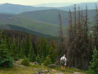
Views to the north from the CDT southbound

A yellowbellied marmot poses for us

Not to be outdone, a golden-mantled squirrel poses too


While we were in the Monarch Pass area we hiked the CDT twice, one time going south from the pass towards New Mexico and the other hike was headed north towards the Collegiate Peaks in Colorado.  Then we hiked another section in far southern Colorado near Cumbres Pass.  

Our southern hike from Monarch Pass was on a very popular section of the trail that is also part of the Colorado Trail (CT).  The CT is a trail that runs 486 miles from Durango to Denver.  David and I tend to pick out trails that are in wilderness areas or are restricted to hikers and horseback riders but on this well-loved part of the shared CDT and CT bicycles are allowed.  

David waits for a cyclist to pass. 

There were many cyclist and most were extremely considerate and no problem for us, it just made for a very busy trail.  One group of cyclists had a drone hovering above filming their ride.  Modern technology!  I guess we shouldn’t have been surprised at the crowd as it is an easy part of the trail to reach.  And Monarch Pass is a popular stopping place for tourists.  There is even a gondola ride that takes tourists up for a view of the surrounding mountains. Fortunately, the crowded trail didn’t last long.  Most cyclists started early and flew past us, so after 10:30 the trail settled down to just a few of us slow hikers.

Great views from just above timberline


Monarch Pass is above 11,000 feet so it didn’t take us long to reach timberline.  In several places we had 360-degree views of all the surrounding mountains.  One barren slope had a small stand of bristlecone pines, a favorite tree of ours.  Bristlecones are some of the longest-lived trees in the world, some being over 4,000 years old like the intermountain bristlecones we saw in California a few years ago.  The Colorado bristlecone species on this trail are the shorter-lived of the bristlecones only reaching about 2,400 years old.  

A dead and live Colorado bristlecone pine

Alpine sunflower, one of my favorite alpine flowers


The next day we crossed Highway 50 and hiked northbound on the CDT.  Our experience was so different on this part of the trail.  The first mile was on a ski road that traversed the Monarch Mountain Ski Area and we didn’t see a soul on this part of the trail.  After we hiked past the ski area, the trail turned off the road and slowly wound through a spruce and fir forest which slowly gave way to a large bristlecone pine forest and then the trail went above timberline for many miles.  This section was restricted to foot and horse travel only and we only saw a few hikers. 

Alpine flowers struggle to grow and bloom above timberline.
We are careful not to get off the trail and damage these fragile flowers.

The hikers we met were Colorado Trail ‘thru-hikers,’ which meant they had started the trail earlier in the summer south of Denver at Waterton Canyon and were hiking all the way to Durango.  We talked to one hiker named Austin who was from Tennessee.  Austin was so happy because it looked like he was going to make it all the way to Durango.  When he started the trail 6 weeks ago, the fires near Durango were not contained and that part of the CT as well as much of the San Juan Forest had been closed.

On the northbound CDT we saw Waterdog Lakes from above.
We had had lunch on the shore below just two days ago.

Since Austin had bought his ticket and planned his hike months ago, there was nothing to do but start hiking and hope for the best.  Austin got off to a very rough start as it was 106 degrees the day he started on the CT and he came down with heat exhaustion on his second day.  He took a few days off to rest and started back on the trail with much more water in his pack.  When we talked with him he looked sunburned and pretty skinny, but he was happy to be only a few weeks away from his goal of finishing the CT.  David and I both admired his determination and bravery, hiking this trail alone in such a hot, dry and fire-prone year.  After finishing this adventure, Austin’s plans were to go back to Tennessee and go to nursing school.   We wished him our very best. 

Continental Divide Trail from Cumbres Pass

Cumbres-Toltec Scenic Train climbing the pass as seen from the CDT


Our last hike on the Continental Divide Trail was near the border of New Mexico near Cumbres Pass.  This part of the trail was a lot of fun because the Cumbres-Toltec Railroad, a narrow-gauge train that is now a tourist train, climbs through the pass in this area.  We were lucky to get glimpses of the train winding through the pass in several places.  As we returned from our hike and were heading back to camp, the train crossed the road right in front of us. Steam was bellowing and the whistle was blowing as the train chugged up the grade.  We’ve always wanted to ride this train and now we really want to because we’ve seen how beautiful the pass is.  The slopes are covered with aspens, so this would be a great train ride to take some fall.

This little train works hard through the pass spewing smoke and steam


We’ve crossed into New Mexico now and are making our way back to Texas.  It is going to be a hard adjustment as we are now totally spoiled to cool weather.  It’s been in the 50s most mornings and I am used to sleeping with blankets.  I don’t think that is going to be the case when we get back to Texas.  Anyhow, we have a few more days in the mountains before we head home so I just won’t think about the heat yet.

Scarlett gilia

Blue bells


David’s Stats:

Days Hiked   4  
Total Miles Hiked  25.5   
Ave. Miles per Day      6.38
Total Elevation Gain     4,000
Ave. Elevation Gain per day  1,000