Sunday, June 26, 2016

Days in Big Meadows


Big Meadows Campground from the opposite shore of the lake


From Alamosa we drove mostly west on Hwy 160 towards Wolf Creek pass stopping in South Fork to visit the Ranger Station and get information on campgrounds in the Rio Grande National Forest.  A campground called Big Meadows was recommended to us and as the elevation there was over 9,000 feet, it was sure to be cooler than where we had been the past few days.  Mountains were all around us and much of the road paralleled the Rio Grande River, at this point a much swifter, narrower and less muddy version of the Rio Grande than we had just seen in New Mexico.


We heard the fishing was a lot better than the 'catching'

We had been slowly gaining elevation all along but after leaving South Fork, the climb became more noticeable.  Turning off Hwy 160 onto a forest road, we soon arrived at Big Meadows and were not disappointed or surprised in the least.  It was indeed a campground in a big meadow by the Big Meadows Reservoir, a nice little fishing lake made by damming the Archuleta Creek. 


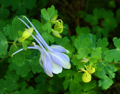
Colorado Columbine

Since the campground had been constructed, Big Meadows was near a meadow and lake.  But events over the past 10 years have made Big Meadows a much bigger meadow.  The spruce bark beetle, a cousin of the pine bark beetle that has caused so much damage to pine trees, has been hard at work all through the Wolf Creek Pass area.  From 50 - 90% of the spruce trees have died in this area, with some of the worse die off being right at Wolf Creek Pass.


Looking at the 'spruce kill' near Big Meadows Reservoir

Sad to see the dead trees but life is blooming in the sunlit openings

We heard from several campers that had been long time fans of Big Meadows, that this campground used to be thick and shady with all the spruce trees.  The forest service has had to cut down the dead trees in the campground so they would not be a hazard to the campers and fishermen.  Today the site is very open and sunny.  Few shady campsites exist.  But after several days in the 90s, sun and 70s sounded just fine.  Actually, our charmed life was beginning to return as we had afternoon clouds and rain showers every day making it very pleasant. 


There were so many blue flowers in the meadow.   

We drove into Pagosa Springs to visit our friends, John and Cindy from Texas, who were also visiting friends in the area.  Cindy made us a nice dinner at Jim and Betty’s beautiful house just outside the city.  It was a lovely evening with amazing views of the San Juan Mountains from the deck.  Then we drove back to the campground for an evening of gentle rain and peaceful sleep.


Cascade Falls

Morning walk around the lake, pretty nice!

Yes, our days in Big Meadows were charmed.  Maya was recovering nicely and we were able to take short walks around the lake and to Cascade Falls.  Later in the week we took a much longer walk up Archuleta Canyon into the Weminuche Wilderness.  It was sad to see so many dead spruce, but hopeful to see so many young spruce pushing up everywhere.  The opening in the forest canopy from the dead trees made it possible for wildflowers, shrubs and aspen to take hold.  Nature has its seasons and as it has been said many times before, “there is a time for everything under the heavens.”  Our days in Big Meadows were our own time for rest, renewal, enjoyment and appreciation of all the good things that life can be.


Maya is learning to 'tolerate' her booty and she was able to walk 7 miles with it on!

Our campsite in Big Meadows, not many big mature trees but still great.


David’s Stats:

Days Hiked    3    
Total Miles Hiked    11.12
Ave. Miles per Day      3.71
Total Elevation Gain     1,172
Ave. Elevation Gain per day    391


Entering the Weminuche Wilderness, Colorado's largest wilderness.


Friday, June 24, 2016

Volcanoes and Sand Dunes -- The Heat is On


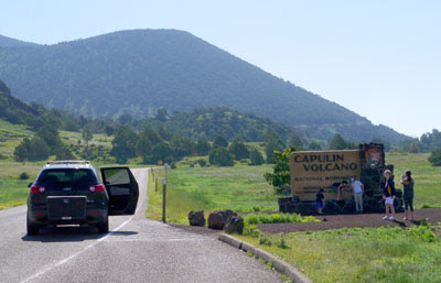
We have seen this 'scene' many times this summer -- making a family portrait.
It is great to see so many people visiting the parks for the 100th Anniversary,
even if they can't manage to pull the car out of the middle of the road.

There may be those out there that get the impression that our life on the road is charmed.  And I’ll have to admit that we work hard to ensure that it mostly is.  I mean, if you have complete control over where you are going, then a lot of unpleasant things can be avoided.  But, not always…

This week on our way to Colorado, we had to come down from the cool mountains in New Mexico before we could climb back up again.  We could have driven straight through and perhaps avoided some heat but there were a few things on our way that we thought would be worth seeing in the high desert.  So we planned two stops that we knew would not be in our ideal temperature range with hopes that at least the nights would be cooler.


View of the Raton-Clayton Volcanic Field from the top of Capulin Volcano
with haze and smoke in the air from fires in Arizona and southern New Mexico.


Reluctantly leaving Columbine Campground, we headed east to Red River and over the mountain pass, descending slowly during the next two hours.  We traveled past Eagle Nest Lake and through Cimarron Canyon State Park, named for the beautiful canyon stretching through most of it.  This state park looked like it was definitely worth a visit.  Another trip, another time...  (How often do I say that?)  It seems the more we travel, the more places we add to our list of “must see.”  The list grows even though we are continually checking places off that we have visited.

Mid-afternoon we arrived at our destination, Capulin Volcano National Monument, about 30 miles east of Raton, NM.  We stayed the night at an RV park in the very, very small village of Capulin that most likely would not exist if the volcano wasn’t just 3 miles to the north.  Our plan was to do a little laundry, get some sleep and visit the monument first thing the next morning before the day warmed up too much.

The RV park was nice but small and had almost no shade.  However, we managed to get a spot under one of the few trees in the park.  The tree was on the south side of our RV so it added some afternoon shade that did help.  There was electricity so we could use the air-conditioner.  We were happy about that although open windows and the fan are our preference.  But when it is in the 90s and the tiny box you live in is heating up in the sun, a noisy air-conditioner can be tolerated.


View from Capulin Volcano looking west at the volcanic field.


The laundry was small with only one working dryer, making it a little more challenging getting the clothes done.  The only store in town had very few groceries so no cream in my coffee the next morning.  But I had my choice of several brands of beer and other hard liquor. (Hum, Bailey’s in my breakfast coffee?)  I guess it is all a matter of priorities.  We made it through the night and even opened the windows after about 10 pm.  Nights tend to cool off nicely when there is practically no humidity.


Capulin Volcano is one of the few cinder cone volcanoes that is so rich in vegetation.


Capulin Volcano, unlike The Rio Grande del Norte National Monument, is administered by the National Park Service.  By 8:15 the next morning we were at the park headquarters talking with a ranger and learning about the geology that formed this part of New Mexico.  Capulin is a cinder cone volcano that was formed about 60,000 years ago, which is very young for a volcano.  Cinder cone volcanoes typically have only one period of activity so Capulin is considered to be extinct.  Luckily its shape is very well preserved because later lava flows did not come from the main cone but from the cone’s base or boca (Spanish for mouth).


Looking from the rim into the volcano's crater


 After checking out some of the exhibits in the visitor center, we drove the winding road up to the volcano crater.  Our Maya was still limping and was obviously in some pain, so she stayed in the car while we walked around the top of the volcano and looked down into the crater.  One of the coolest things that the ranger had told us was that there were hundreds of other volcanoes surrounding Capulin.  Volcanic flows, rock, ash and debris are found in an 8,000 square-mile volcanic field surrounding Capulin Volcano and this was apparent from our vantage point at the top.  The Raton-Clayton volcanic field, as it is named, was active for about 9 million years.


Another hazy view from the top of the volcano


We were back at the campground by 10:30 and on the road by 11:00 to Alamosa, Colorado and the Great Sand Dunes National Park and Preserve.  We had visited this park briefly years ago and had always wanted to return and spend more time.  But as I mentioned earlier, our life was not very charmed at this point.  Maya was hurting and I wanted to take her to a vet to see if maybe there was a thorn or something embedded in her paw that we couldn’t feel.  Also, it had become increasingly hazy over the last couple of days.  Smoke from fires in Arizona and southern New Mexico were blowing towards the north making the views and the air not at their best quality.  Plus, the temperatures were supposed to climb into the mid-90s over the next few days.  All of these things made it unlikely that we would get to explore or hike in the Great Sand Dunes very much.


Wildflower growing near the rim of Capulin Volcano


Our campground was dusty, with no shade and it was hot!  Our air-conditioner ran full-time just to keep the RV in the 80s.  But we did find a vet who saw Maya.  He gave her paw a good exam and found no broken bones or thorns and declared (just as we thought) that it was probably bruised from the rocky trails of the past few days.  The vet prescribed an anti-inflammatory to ease her pain and a bandage on the paw with instructions to keep resting her.


The Great Sand Dunes nestled against the Sangre de Cristo Mountains
near Alamosa, Colorado.  The upper atmosphere was less hazy
but it was still smoky in the lower atmosphere.


We took a driving tour of the Great Sand Dunes but it was smoky and the photo opportunities were limited.  We still had some fun and learned a bit about why the sand dunes formed here.  These dunes are North America’s tallest, with Star Dune topping out at 755 feet (sometimes a little more, sometimes a little less). 

A wild natural system of sand, water and wind plus the Sangre de Cristo Mountains are needed to form these remarkable dunes.  Sand is created by streams eroding particles from the mountains.  Freezing and thawing shatters the rocks and the streams continue to tumble the particles until sand is formed.  The complex wind patterns through the mountain passes push the sand against the Sangre de Cristo Mountains and then seasonally powerful northeasterly winds build the dunes to their great heights.


Grassland, dunes and the Sangre de Cristo Mountains.
The dunes may not look that tall but those are mountains behind them!


This park is also amazing for the number of life zones found here.  Seven life zones from above the timberline to the stream side wetlands are found in the park:  alpine tundra, subalpine, montane forest, dunefield, sand sheet with grassland, salt-encrusted plain and wetlands.  The wealth of habitats and diversity of plant and animals in the park could keep a person busy studying for quite some time.


Medano Creek, one of the seasonal creeks that helps form the sand dunes. 
The creek was running during our visit and the mosquitoes were out in force!
But after last year in Michigan's upper peninsula, it seemed insignificant...


While we wanted to spend more time at the Great Sand Dunes, it just wasn’t in the cards this trip.  Maya was starting to feel better, but she still needed some more days off from hiking and the weather just wasn’t cooperating.  So we left after two days for the mountains near Wolf Creek pass.  At least we could be cool and out of the smoky haze while Maya recuperated.


Maya sports her new protective 'bootie' over her bandaged paw.


David’s Stats:

Days Hiked:  none, Maya out of commission
Smoky Days:  2        


Sunday, June 19, 2016

More Wilderness and a National Monument


The Canada Violets have been spectacular this spring in the mountains


A short drive heading west from Red River brought us to Columbine Campground in the Carson National Forest just 5 miles east of Questa, NM. This beautiful campground is nestled in a narrow canyon with Columbine Creek flowing through the middle and then joining with the Red River just below the campground.  The steep walls of the canyon plus the thickly forested campground provided ample shade and as temperatures were on the rise, it seemed like the perfect place to stay for the week.

 
View along the Columbine - Twining National Recreation Trail

After an easy afternoon of enjoying the creek, cooking dinner and then a great night’s sleep, we woke rested and ready for some hiking.  From our campground, the Columbine Canyon Trail #71 led into the Columbine-Hondo Wilderness where it intersected with several other trails in the wilderness providing us with many hiking options to consider.  We decided on attempting part of the Columbine - Twining National Recreation Trail which started out on Trail 71 and then followed the Deer Creek Trail, then the Gold Hill Trail (at 12,711 feet, Gold Hill is more than just a hill) and eventually ended at the Taos Ski Basin for a 14.2-mile trek.  We knew we would not be going that whole distance and climbing nearly 5,000 feet in elevation in the process, but we decided to start hiking and see how far we got.

 
Maya appreciates a sturdy bridge when the streams are full and swift


There were several stream crossings but thankfully bridges were intact, so no problem there.  When we turned off the Columbine Canyon Trail to follow the Deer Creek Trail, we started a shady climb through a young aspen forest that was beautiful with flowers.  But after about a mile the trail topped out of the aspens into a sunny west facing slope and began climbing in earnest.   We went on for another couple of miles as the trail teased us with glimpses of blue sky.  But every switchback brought us to another slope to climb and the top with views of Gold Hill remained ever illusive.  It was getting warm on the sun-soaked slope and the rocks were many and sharp.  We were concerned about Maya’s paws so we decided to head back to our cool canyon campground.


Maya rests her paw


The next day we drove over to the Taos Ski Valley and hiked the other end of the Columbine – Twining N.R.T. so we could at least have tried both ends.  This end of the trail was just as steep and rocky as the other and by the time we were done Maya was beginning to favor her left front paw.  Although we enjoyed both ends of this National Recreation Trail and the scenery was gorgeous, it was seriously rocky.  The trail is rated difficult and we all thought the rating was deserved though we didn’t even hike the steepest section that climbed Gold Hill. 


Marsh Marigold along Deer Creek


Thursday Maya’s limp was even worse and we decided she needed a day or two off so we went on a car excursion.  The Rio Grande del Norte National Monument was just about 10 miles away from our campground and it seemed like a good time to explore this very new national monument.  Being quite familiar with the southern end of the Rio Grande and having taken many a canoe trip down the ‘Rio’ in Big Bend, we thought it was time to enjoy and learn about the northern end of this grand river.

 
Rio Grande del Norte National Monument


Part of our mission this summer is to explore some of the lesser known and visited National Park Service administered sites in celebration of the 100th Anniversary of the National Park Service.  But the Rio Grande del Norte National Monument is not administered by the NPS.  Things are sometimes confusing when it comes to our Congress and government (and that is as political as this blog will ever get).  It seems that not all national monuments are the same.  The best that David and I can figure is that the land of the Rio Grande del Norte was originally under the administration of the Bureau of Land Management (BLM).  So when President Obama proclaimed this area a national monument in 2013, it stayed under the management of the BLM.


Prickly pear cacti were in bloom all over the monument

Looks like a fun rapid
The Rio Grande is almost as brown here as it is in Texas


Regardless of all that, we were not going to let a technicality keep us from visiting a very cool national monument.  We drove through the larger, northern part of the monument, known as the Wild Rivers section.  Here both the Rio Grande and Red Rivers flow wild and undammed through the 242,455 acres of the monument.  There are many scenic pullovers with views of both rivers and trails that take you along the top edge of the two canyons and some trails descend down into the canyons.  We did every pullover and visited the many campgrounds in the monument, all of which were nice.  We took very short walks along the tops of the canyons while Maya rested in the car (parked under shade).

 
The confluence of the Red River and the Rio Grande
Red River is on the left and Rio Grande is on the right


The Wild Rivers Visitor Center was very fun to visit and there we learned that the Rio Grande had help making its canyon or gorge of over 800 feet deep.  The canyon is actually part of the Rio Grande Rift that it is slowly pulling the land apart.  This weakness in the earth’s crust has also allowed multiple volcanic fields to arise in New Mexico these past few million years. (Don’t you just love geologic time?  A few million years is hardly any time at all…)


My Tia's in the middle of nowhere but worth the trip


After all this new exploring and knowledge, we were hungry and asked the ranger to recommend a good place to eat.  He directed us to My Tia’s in the little village of Cerro on our way out of the monument.  It was an excellent suggestion –  home cooked, fresh and local food.  My stuffed sopapilla with chicken, beans and green sauce was delicious and huge!  David and Maya had to help me finish it.  I love those rangers; they always know the best places to eat.

 
The Rio Grande Gorge Bridge north of Taos, NM


With Maya still limping on Friday, we decided to finish our tour of the Rio Grande del Norte and we drove to the Orilla Verde section of the monument that is about 12 miles south of the famous Rio Grande Gorge Bridge or High Bridge near Taos.  Although we have seen the bridge several times before, we stopped again on our way to the southern part of the monument.  The bridge stretches over the gorge at a height of 564 feet above the waters of the Rio Grande and it is always an impressive sight.


Looking down into the gorge from the bridge -- pretty awesome!


The southern part of the Rio Grande del Norte is mainly a “floater’s or river runner’s paradise.”  Rafting companies and outfitters are everywhere and will shuttle you between put in and take out points.  This part of the river reminded us a lot of the Rio Grande down in Texas.  It was even the same shade of brown!  I guess that old Rio Grande always carries a lot of sediment as it rolls along. 

 
Looks a lot like the Rio Grande near the Texas border


Both sections of the Rio Grande del Norte are in a high desert environment and were much warmer than our sheltered Columbine Canyon Campground.  But the day we visited the southern section, the temperatures reached the 90’s.  It wasn’t just warm, it was hot and suddenly, we were not avoiding summer anymore.  

 
The walking stick cholla cactus were aflame with blooms


We headed back to our cool canyon to enjoy one last night before moving on to perhaps some even warmer places before we would arrive in the mountains of Colorado.  But first, one more trip to My Tia’s.  That was some seriously good food.


David’s Stats:

Days Hiked   2 
Total Miles Hiked    13.08
Ave. Miles per Day    6.54 
Total Elevation Gain     3,120
Ave. Elevation Gain per day  1,560


The desert in bloom is glorious!


Monday, June 13, 2016

Red River and a New Wilderness


The highest peak in NM, Wheeler Peak from the Sawmill Park Trail


Thankfully, we had an uneventful drive from Santa Barbara Campground back to the “High Road to Taos,” driving first to Taos and Questa then on to Red River to camp for the weekend.  Although June can be one of the hottest months in New Mexico, so far we have experienced wonderful weather.  Warm days, cool nights with afternoon and evening thunderstorms nearly every day – pretty perfect as far as we are concerned.  This lovely pattern continued through our weekend in Red River. 

Hiking through a mature spruce forest
It was so good to see the healthy spruce in this area as so many spruce
have been killed by bark beetle throughout the country.

Nearly lost in the thick, young spruce forest

Our campground in Red River was only a few miles from the Wheeler Peak Wilderness and David and I had never hiked in that wilderness.  Bright and early on Saturday morning, we drove the few miles to the trailhead for a new wilderness adventure.  There were two options for trails to hike, one of them leading to the high country and joining with another trail to Wheeler Peak (the highest mountain in NM at 13,161 feet).  We were just recovering from our recent snow hike and not quite ready to summit the snow covered Wheeler Peak, thus we opted for the lower trail to Sawmill Park which respectably enough climbed to 10,980 feet and was a little over 10 miles round trip.


The "Big Ditch" (on the left, trail on right)

The trail crossed “The Big Ditch,” also known as the Elizabethtown Ditch, which was constructed in 1868 by the Moreno Valley Water and Mining Company to transfer water from the Upper Red River Watershed to the gold fields in Moreno Valley.  The ditch was 41 miles in length and included 3 miles of elevated wooden flumes.  But today all that remains is the overgrown depression where the ditch once existed.  400 men hand dug the ditch.  When we hike in historic areas like this, it always amazes me that people were able to even get to the places to begin with, with no roads and only horses and sometimes wagons.  And then to build, farm, mine or process timber in these steep, rocky areas with only hand tools – that’s just incredible to me.  I can barely walk the trails with modern equipment.


Maya being her goofy self


Our hike turned out to be one of those near perfect times that was just too much fun and part of that was due to our crazy dog.  Maya was in a silly, playful mood all day and kept us laughing at her escapades (more about that in a moment). 

Although perfectly capable of getting her own snow, Maya prefers it from
the center of the pile and fed to her by David.

The Sawmill Park Trail climbed but not too steeply, and the couple of stream crossings were easy.  It was fun reading the signage at “The Big Ditch” and learning some history of the area.  Once we reached Sawmill Park, a large and beautiful mountain meadow with a meandering stream flowing through the middle, the spruce, fir and aspen trees were joined by Bristlecone pines (some of the very oldest trees in the world and a favorite tree of ours). 


1000 year old Bristlecone, 60 year old Cindy, 12.5 year old Maya
"Some old babies"

Two years ago, we visited the Ancient Bristlecone Pine Forest in California’s Inyo National Forest and learned a lot about these extremely long-lived trees.  The trees in California live in a very poor soil and have little competition so they can live over 4,000 years.  The oldest Bristlecone Pines we encountered in Sawmill Park were only around 1,000 to 1,500 years old!  It was cool to see the Bristlecone growing in a very different environment, this one in New Mexico much more lush and with a diversity of other trees.  (See June 2014 blogs for more info on the Bristlecone Pines.)


The little stream in the meadow, our stop for lunch


We had planned to lunch by the twisting stream in the middle of the meadow but just as we were about to sit down, Maya decided to take a little wade.  That is what she thought anyway.  The stream wasn’t more than 2 to 3 feet wide but it was much deeper than Maya anticipated.  As she placed her feet on the edge to ‘wade in,’ she plunged into the stream head first and disappeared under water. 


It's a lot deeper than it looks!

"I never saw that coming..."


Was she ever surprised!  She bobbed to the surface looking quite miffed and David had to help her out as the bank was quite steep.  The water was freezing cold so poor Maya was running, rolling and shaking all over the place getting us wet in the process.  After we finished laughing, we moved to a sunny spot up slope and dried her off best as we could, all of us having lunch in the sun to warm up.


Shake it off...

After that Maya was just a silly girl, romping and doing all kinds of crazy things.  She enjoyed the few snow drifts we encountered and sniffed for critters in the meadow.  But when we got back to the car, she practically collapsed in the back seat.  I had to shake her awake when we got back to the RV.  She was one tired dog.  We all were ready for bed early.


And roll...


Sunday we recuperated and did a few chores.  Later this morning we will leave Red River for a nearby forest campground.  We hope to hike again in the Wheeler Peak Wilderness and two other nearby wildernesses.  It will be a week of new wilderness areas for us. 

Back on the trail and headed 'home'


David’s Stats:

Days Hiked  1  
Total Miles Hiked   10.07  
Total Elevation Gain     1,298