 |
| First stop - Mt. St. Helens |
Neither
David or I had ever been to Mt. St. Helens and it wasn’t very far from Astoria, so we decided that would be our first stop in Washington. We were mere newly weds when the 1980 eruption occurred and we remembered watching the coverage on TV. Very soon we came upon one of several Mt. St. Helens Visitor Centers, this one at Silver Lake on Hwy 504. Seaquest State Park was right across the road from this visitor center and we found a very nice campsite there.
We spent the afternoon hiking around the many short trails in our campground and then went over to
the Mt. St. Helens Visitor Center. We
took in a very informative Ranger Program about the May 18, 1980 eruption
and then we walked the 1 ½ mile loop nature trail around Silver Lake. The views of Mt. St. Helens that day were very hazy as even Washington has not been immune to fires this summer.
 |
| Hazy view of Mt. St. Helens from Silver Lake |
The next morning we spent a little more time at the visitor center at Silver Lake then
we drove further up Hwy 504 to check out the views and the other three visitor
centers along this road. We especially wanted to visit the Johnson Ridge
Observatory/Visitor Center (4,200 ft.) which has the crater view and was in the
blast zone of Mt. St. Helens on that fateful day.
The Johnson Ridge Observatory is operated by the US
Forest Service as part of the Mt. St Helens National Monument and it was very
impressive. There was an extensive
nature trail (Eruption Trail) around the area, the center itself had
interpretive exhibits and a huge theater with Mt. St. Helens movies every half
hour plus regular Ranger Talks were continually going on in several places around the
center.
 |
Above: View of crater from Johnson Ridge Observatory
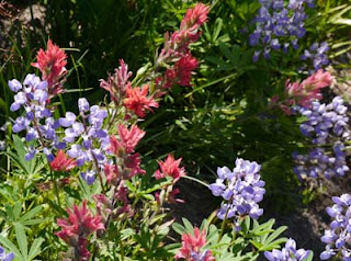
Below: Wildflowers grow well in the blast zone
|
It was especially interesting to see how the forest was recovering around
the St. Helens area and the different approaches to recovery. Most of Mt. St. Helens is located in the Gifford Pinchot National Forest and the Forest Service was allowing a natural
recovery around much of the crater and monument area. But the eruption also gave researchers a tremendous opportunity to experiment with different recovery methods. So there were many areas outside the monument area
that were being selectively thinned or not thinned and some areas seedlings were being planted under certain conditions to be studied by researchers.
Then the timber companies such as Weyerhauser planted mostly Noble and Douglas Fir in their forests around Mt. St. Helens. The commercial company areas looked like tree
plantations without much diversity, but to some people those areas may look
better because the trees are bigger there and it looks more like a forest.
Thirty-two years later and things are very slowly and naturally recovering around the crater
area. One interesting result of the research so far is that birds favor the naturally recovering areas. A far greater number of bird species prefer the unmanaged stands of forest and the highest number of breeding songbirds live in the unmanaged stands with standing dead trees, next to water.


