Monday, June 30, 2014

The World's Tallest Trees


The bottom 30 feet of the tallest tree in the world
363 feet tall


On our travels this year we have seen some of the world’s largest trees, the Giant Sequoias and some of the world’s oldest trees, the Bristlecone Pines so it was only fitting that we visit should see some of the world’s tallest trees, the Redwoods.


Redwoods and Giant Sequoias are both members of the Redwood Family.  While Giant Sequoias are among the world’s largest trees and can live up to 3,200 years old, Redwoods live 'only' around 2,000 years!  But they are the world's tallest trees. 
 
Giants of the forest
 
During past vacations, we've seen Redwoods near San Francisco and along the northern California coast but one place we had never visited was Humboldt Redwoods State Park.  Located on Hwy 101 about 50 miles south of Eureka, this beautiful park encompasses over 52,000 acres including 17,000 acres of old-growth Redwoods and the stunning Rockefeller Forest, the largest remaining old-growth Redwood forest in the world.


Redwood sorrel, a clover like plant that often 'blankets' the floor of Redwood forests 


Once upon a time back in the age of dinosaurs, fossil records indicate that Redwoods grew naturally in many places across the Northern Hemisphere.  Now all that remains is a small coastal fog belt 5 – 35 miles wide extending 450 miles from extreme southwest Oregon to central California.  Before the arrival of European settlers to North America, this coastal strip of land was covered in Redwoods but today they grow in only a fraction of that area. 


Looking up to the canopy


As we drove the scenic “Avenue of the Giants” (the park road through Humboldt Redwoods State Park) passing through the groves of immense Redwoods we couldn’t help but compare it to other areas outside the park where most of the Redwood groves were gone.  Many of the Redwood forests have been saved but they are mainly in the state and national parks with very few, especially the old growth groves, existing outside the parks. It can’t help but make you sad.  But the Save-the-Redwoods League has been working tirelessly since 1917 to preserve areas of primeval Redwood forests.  To date the League has protected 170,000 acres of Redwoods in 35 California State Parks and two national parks.
 
Visitors to the forest dwarfed by the towering Redwoods
 
Fallen log gives life to new plants
 

A Redwood forest must be experienced.  In some places the trees are so tall and thick that little light reaches the forest floor.  Often the forest is shrouded in mist or fog.  It is an effort to see to the tops of the trees – if you even can.  Fallen giants have become a nursery for new plants.  Mosses, ferns, flowering plants, shrubs, and even new Redwoods cling tightly and draw life from the ‘old bones’ of the ancient trees.  Walking through these magical forests is an experience of wonder and for some, renewal.  Words and pictures can only hint at the mystery.  


David's Stats:
Days Hiked       3
Total Miles Hiked      7.56
Ave. Miles per Day      2.52
Total Elevation Gain       767
Ave. Elevation Gain per day   256


Monday, June 23, 2014

Diners to Volcanoes


Lassen Peak, one of the world's largest plug dome volcanoes
It is considered still active...


From Lake Tahoe, we traveled north about 20 miles to Truckee, CA where we treated ourselves to lunch at Jax on the Tracks, a local diner that was featured on The Food Network’s show, Diners, Drive-ins and Dives.  Although Jax’s Diner was not the reason we stopped in Truckee, it did seem a good thing to try while we were there and so we did.  David ordered the pulled pork and cheddar sandwich and I tried the ‘All Day Addiction,’ an interesting mix of flavors and one of the prettiest dishes I have ever been served. 


Lunch at Jax on the Tracks, a local Truckee diner
 
You know what to expect when ordering a pork sandwich but the All Day Addiction, which was indeed served all day long, was a bit more complicated.  It started with a bed of triangle hash browns (just what it sounds like, hash browned potatoes in a triangle shape) to which Canadian bacon was stacked, then a bed of mixed greens with avocado and tomatoes and on the very top – two eggs cooked ‘your way.’  To top it all off, pesto sauce and a balsamic vinegar reduction sauce were generously drizzled everywhere.  Breakfast and salad are two of my favorite meals and this was a way to have both at once which I had never thought of doing before.  David and I were both stuffed and Maya got a few bites when we were done.  (Maya preferred the pulled pork.)


Middle Fork of the Yuba River
Hiking the PCT near Plumas-Eureka State Park


Our next stop was 40 miles north of Truckee to camp for a couple of nights at Plumas-Eureka State Park.  Less than 60 miles from Lake Tahoe, this state park is tucked into a little-known corner of the Sierra Nevada with the Pacific Crest Trail just a few miles away.  It is amazing to me that if you look around a very popular place you can usually find other gorgeous places nearby with a fraction of the number of people visiting them.  We found that to be true near Yosemite National Park by visiting the Inyo National Forest and Mammoth Lakes area and it was equally true for the Tahoe area.  It seemed that the number of people dropped exponentially as the miles from Lake Tahoe increased.


Gorgeous Tiger Lilies blooming along the trail
 

We stayed two nights at Plumas-Eureka State Park enjoying the beautiful piney woods, glacier-gouged lakes and very lovely campground.  Most California State Parks don’t allow dogs on the trails, so we only took a few short walks in the park without Maya.  We did make it up to Maya by taking her with us to hike a lovely section of the Pacific Crest Trail just outside the park. 

This section of the PCT was heavily forested – a big change from what we had experienced near Mammoth Lakes.  There were a few portions of the trail that traversed open meadows or a rocky slope or two, but we were mostly in the shade.  We crossed several creeks and the Middle Fork of the Yuba River where we saw the small but pretty Love Falls.  The trail was just about perfect – some climbing but not too much, lots of shade, water for Maya to wade in and the sunny places were filled with blooming wildflowers.  A very good time was had by all!


Leaving 'lake country' behind and climbing up the Volcano Road
 
Next we traveled a little over 100 miles north to Lassen Volcanic National Park, a gorgeous landscape created by lava flows, carved by glaciers and dotted with lakes and clear rushing streams.  All four types of volcanoes can be seen in the park.  Lassen Peak is one of the world’s largest plug dome volcanoes and its last largest eruption was on May 22, 1915.  The park also contains composite, shield and cinder cone volcanoes plus many geothermal features.  It is a geologic wonder and much less crowded than many national parks.


Lake Helen with Lassen Volcano on the right

Close up of the top of Lassen Volcano showing 'the eye'
This natural feature in the lava is said to be the eye of the god, Vulcan,
the Roman god of fire. 


Again, we weren’t able to hike that much because Maya wasn’t allowed on the trails.  So we walked the shorter Nature Trails, stopped at the roadside exhibits and enjoyed learning all about the park’s volcanic and geothermal activity plus how the forest has recovered and become more diverse since the 1915 eruptions.


Mountain Mule Ears were in bloom, 
creating fields of gold on the mountain slopes


One afternoon in our campground we saw some National Park Service workers with long poles attaching little black packets high on the trunks of Jeffery Pine Trees.  We were curious so we asked what they were doing.  It seems that the Jeffery Pines which are similar to Ponderosa Pines are being heavily infested by the Jeffery Pine Bark Beetle. 


Glacial erratic, or in this case, a boulder left behind when the glaciers melted
 
 
Many species of western conifers have been suffering from bark beetle infestations and many trees have died.  So the NPS is doing field studies in popular areas such as picnic grounds and campgrounds to see if they can save some of the Jeffery Pines.  The packets they were attaching to the trees contained synthetic beetle pheromones which would hopefully tell the beetles that this tree was already infested and ‘full’ and that they should look elsewhere for a home.  Hopefully this technique will work and some of the Jeffery Pines will be saved.


Sap running from tree that has been infested with bark beetle
The tree tries to defend itself by 'flushing' out the beetle with sap
 
We loved our time in Lassen and learned a lot.  In our campground, we met two other Texan couples, one from Austin and one from San Antonio.  We were all so happy about the Spurs winning the Championship.  Go Spurs Go!

Now it is on the Redwoods for the first full day of summer.


Lassen Volcano with one of the many beautiful, clear streams
 

David's Stats:
Days Hiked      2
Total Miles Hiked       9.47 
Ave. Miles per Day      4.74
Total Elevation Gain       1,462
Ave. Elevation Gain per day   731


Thursday, June 19, 2014

Another lake, another wilderness


Emerald Bay at Lake Tahoe


Two weeks of almost non-stop hiking and sight-seeing excursions in the northern Inyo National Forest left us tired and happy but behind on blog postings and other communications.  There was some phone service while we were hiking the High Trail but none at our last campground in Reds Meadow.  We did manage to make a few phone calls and e-mails and to make one blog post as we left the Mammoth Lakes area with the thought that we would have better luck in Lake Tahoe.  But it seems the Sierra Nevada Mountains are conspiring against us and even in the Tahoe area service was very spotty.
 

Maya enjoying some 'down time'
 
When we reached Lake Tahoe, it was a Sunday and there was an event of some kind going on.  The traffic was just crazy and it took us about 30 minutes to travel less than 10 miles on the Emerald Bay Road.  We decided that the US Forest Service campground near Fallen Leaf Lake would be the place for us, away from the crowds.  But the price we paid was no Internet or phone service. 


Into the Desolation Wilderness...


The granite rock in the Desolation Wilderness makes it look stark and lonely
 
Fallen Leaf Lake is a beautiful little lake off the southwest corner of Lake Tahoe.  It is on the border of the Desolation Wilderness with many hiking trails nearby.  We stayed there five nights and took three hikes into the wilderness with two of the trails being on sections of the Pacific Crest Trail.  And of course we spent some time at Lake Tahoe since neither of us had ever visited there before.


Upper Glen Alpine Falls near Fallen Leaf Lake 


At 1,645 feet deep, Lake Tahoe was just as beautiful as we had heard.  We learned from taking the nature trails around the Taylor Creek Visitor Center that the incredibly clear waters of Lake Tahoe are kept clean by marshes, wetlands and meadows that surround the lake and filter the sediments from the water.  In the United States, only Crater Lake in Oregon is deeper.  There are 63 rivers and streams that flow into Lake Tahoe, but only one river flows out – the Truckee River.  Unlike most lakes, the water from Lake Tahoe never reaches the ocean.  It flows out into the Truckee River and then into Pyramid Lake in Nevada.


Upper and lower Echo Lakes from the Pacific Crest Trail


Maya does a short 'solo' hike on the PCT
 

There are ski areas, marinas, resorts and beautiful houses all around the lake shore but we spent most of our time hiking the trails in the Desolation Wilderness.  Of the four wilderness areas near Lake Tahoe, we were closest to the Desolation Wilderness.  The three other wilderness areas were harder to reach.  And that is one of the downsides of the Desolation Wilderness – it is not desolated.  This wilderness is so easy to access from Lake Tahoe that it is being ‘loved to death.’  It is the highest visited wilderness area per acre of any in the United States.  Day use is still unlimited but anyone wanting to backpack and stay overnight must make a reservation Memorial Day through the end of September.  Only a certain number of overnight campers are allowed during this time.  Since we were only day hiking, the quotas were not an issue for us.
 

Cascade Lake with Lake Tahoe behind
 
But we did see more people on the trails than we have anywhere yet.  It didn’t spoil the wilderness experience, but we could see how it might if the numbers continue to grow.  What a conundrum!  Wilderness is something many people crave and so it seems a shame to have to ‘regulate’ the number of people visiting.  However too much access creates heavy use and thus impacts the wilderness negatively.  Lake Tahoe is one very popular place.

Our solution was to enjoy a few days in a beautiful place we had never been but then to move on to less popular parks.  So after three very gorgeous hikes in the wilderness, we decided to head north for a lesser known state park, Plumas-Eureka and then on to Lassen Volcanic National Park.


David's Stats:
Days Hiked     4 
Total Miles Hiked   30.12     
Ave. Miles per Day      7.53
Total Elevation Gain     5,002 
Ave. Elevation Gain per day   1,251


Tamarack Lake in the Desolation Wilderness


Saturday, June 14, 2014

Into the Wilderness...


David and Maya on the Pacific Crest Trail, High Trail section

After a hectic few days in Mammoth Lakes of seeing as much as we possibly could and resupplying and recharging everything, we left civilization behind and headed up the steep and narrow road into the Reds Meadow valley for several days of wilderness hiking. 

We stayed in Reds Meadow campground just outside the Ansel Adams Wilderness and a short hike away from the Pacific Crest Trail (PCT).  The Pacific Crest Trail is to the west what the Appalachian Trail is to the east.  Running from the California border with Mexico all the way to the Washington border with Canada, the PCT traverses deserts and climbs through several mountain ranges including the Sierra Nevada and Cascade Mountains.  Although the Pacific Crest Trail isn’t as old and well-established as the Appalachian Trail, it has become quite popular.  Since we spent so much time last year taking hikes along the AT, we wanted to do some hiking along the PCT this year.
 
Maya likes to pose by Wilderness signs
 
Shadow Lake in the Ansel Adams Wilderness
 
Shadow Creek cascading from Shadow Lake
 
A few quick facts about the Pacific Crest Trail – it is 2,663 miles long and ranges from 140 feet above sea level at the Oregon/Washington border to 13,153 feet at Forester Pass in Sequoia National Park.  Some people ‘thru-hike’ the trail from beginning to end usually taking 6 – 8 months.  Most of those hikers start the trail at the Mexico border in April and try to finish by early October before the first major snow falls in the northern Cascades.
 
Glacier polished and striated rock near Shadow Lake
 

We took three long hikes in the Ansel Adams Wilderness while we were in the Reds Meadow area.  One hike was strictly on the Pacific Crest Trail, one hike was partly on the PCT and partly on the John Muir Trail and one hike was to gorgeous Shadow Lake.  All three hikes were long, rugged and beautiful but our favorite was probably the section of the Pacific Crest Trail known as the ‘High Trail.’  It was truly a high trail that climbed steeply into the wilderness but paid off with magnificent views of the surrounding mountains and an amazing view of Shadow Lake from way up high.   
 
Aspen Meadow on the 'High Trail' section of the PCT
 

Another reason this hike on the High Trail was so much fun was that we talked to several PCT thru-hikers.  Like hikers on the Appalachian Trail, PCT hikers get trail names too.  We talked to ‘Ghost Angel,’ a woman who just turned 65 the first of June.  She was hiking the trail solo to celebrate.  Her husband was her ‘trail angel’ and he met her as often as possible along the trail to give her supplies and then hike with her a few miles before he turned back.  She had just said goodbye to her husband when we met her and she was a little teary-eyed.  We also met Turkey Feather and Gear Slut, two solo guys, who were hiking together that day.  Zippy, Grape Nuts and two other guys that we didn’t get trail names for also shared stories with us.
 
View of Shadow Lake and Shadow Creek cascade from the High Trail

It was fun to see the lake from way on high when we
had been dangling our toes in it just the day before.


Everyone told us about the hardships of the late snows in the Sierra Nevada this spring.  One guy was stuck in his tent for two days during a heavy snow and white-out.  Two other guys lost the trail in the deep snow and were off trail for more than 3 miles before they finally found the trail again.  All the hikers were looking forward to reaching Tuolumne Meadows in Yosemite because after that point they wouldn’t be required to carry the bulky bear canisters to store their food.  The bears aren’t as bad from that point on and the canisters aren’t required anymore.  But I might be tempted to carry that bear canister just in case…
 
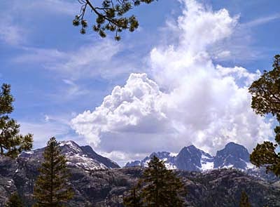
This section of the Pacific Crest Trail had so many beautiful mountain views


From what we experienced, the PCT isn’t nearly the shady ‘long green tunnel’ that the Appalachian Trail is.  Portions of the trail were in the shade but much more of it was out in the open sun.  All the hikers we met were covered in clothes, hats and globs of white sunscreen from head to toe and they all looked sunburned.  David and I both got a bit of sun that day as well.  My trail name could have been ‘Lobster Legs.’  Alas, I had on shorts…

Showing off my 'lobster legs'
I learned my lesson and wore pants and long sleeves the next day


Our time in the wilderness was just what wilderness is supposed to be – a beautiful, primitive place untrammeled and undeveloped by humankind with opportunities for plenty of solitude.  We did pass a few other like-minded souls on the trail but after a few words, we parted to follow our own journeys.
This year marks the 50th Anniversary of the Wilderness Act.  We started our celebrations at the beginning of our journey this spring by hiking in the very first wilderness, The Gila.  It all started in 1924 with Aldo Leopold’s influence on the forest service to set aside that first 500,000 acres of the Gila for wilderness protection.  In 1964 Congress passed the Wilderness Act and now there are 758 designated wilderness areas in the country, totaling almost 110 million acres – nearly 5% of the total U.S. land area.   Although we will not visit every wilderness, we plan to continue the celebrations by hiking in wilderness areas all year long.  


Mule ears, a beautiful composite flower with long, fuzzy leaves


David's Stats:
Days Hiked       3
Total Miles Hiked   29.62      
Ave. Miles per Day      9.87
Total Elevation Gain       4,395
Ave. Elevation Gain per day   1,465
 

'Pussy paws'


Excursions around Mammoth Lakes


11,053 foot Mammoth Mountain
Ski area in winter and mountain bike park in summer


Besides our wonderful day trip to the Ancient Bristlecone Forest we enjoyed a few other excursions during our short stay in Mammoth Lakes.  This area of the Sierra Nevada is not only rich with alpine scenery but geologic wonders as well.  Evidence of glaciation and both ancient and recent volcanic activity are scattered all over the place.  We visited an earthquake fissure, two volcanic explosion pits which contain small lakes, the dormant volcanic peak of Mammoth Mountain plus a ‘pile’ of lava columns better known as the Devils Postpile National Monument.
 
One of the Inyo Craters, formed by volcanic explosions
 
The Devils Postpile National Monument


The Devils Postpile is a remarkable geological feature of tall, vertical columns formed by a flow of basaltic lava.  As the molten lava cooled and contracted to solid rock, cracks formed at 120-degree angles to absorb the stress.  Cracks merged with other cracks and created the hexagonal columns.
 
Some columns have been twisted and distorted
 
Many of the columns have collapsed creating a sort of ‘pick-up sticks’ pile of hexagonal rocks at the base of the still intact column formation.  Add to that the bending and folding of the columns by earth movements and you have the chaos of the Devils Postpile.


We hiked around the monument marveling at the huge columns.  There is a trail to the top of the "pile" where the surface of the columns have been polished smooth by glaciers.  So the side view is one of tall pillars of rock and the top view looks like hexagonal paving stones.  Amazing...  Nature uses the hexagon shape in many things - bee hives, soap bubbles, salt flats and turtle shells.
 
The top of the 'pile' looks like paving stones
Notice the parallel grooves or glacial striations carved in the rock by moving glaciers 
 
 
From the Devil's Postpile, we took the trail along the San Joaquin River to Rainbow Falls.  The falls is formed by a lava ledge. The San Joaquin River plunges down this ledge 101 feet into a deep gorge.  Rainbow colors form in the mists below the falls.
 
Rainbow Falls

 
Another trip we took was an afternoon drive north on Highway 395 to Mono Lake, an ancient salt lake covering 60 square miles.  David and I had visited Mono Lake back in the 1980’s before it became the nation’s first “National Forest Scenic Area” enabling the US Forest Service to begin protecting this unique resource.  


Mono Lake with tufa formations near shore
Tufa is formed by the mineral deposits of once flowing springs


Mono Lake is an excellent example of how America’s view of the environment and of using land and water has changed for the better.  Since the 1960’s the city of Los Angeles diverted the fresh water streams that flowed into Mono Lake for its own use.  At the time, most likely the thinking was that a salt lake didn’t need fresh water flowing into it and the people of Los Angeles did need fresh water.  (Why Los Angeles thought it had a right to water more than 350 miles away that never flowed toward the city is a whole other matter, but I won’t even go there.) 

Mono Lake is two-and-a half times as salty as seawater and maybe that made it seem too inhospitable to support much life and thus okay to take the fresh water away.  But the water of Mono Lake teems with life!  Brine shrimp and alkali fly larvae attract millions of migrating birds and many California Seagulls use the lake for nesting grounds and to feed their young.  
 
More tufa formations in the lake
 

Over the years as more and more water was diverted from Mono Lake, the water levels dropped and the chemistry of the lake changed threatening the shrimp and fly larvae and the birds that depended on this food source.  What was once a healthy ecosystem was in real danger of disappearance.  Many people and organizations advocated for protective action for Mono Lake.  And to make a long story short, a compromise was reached in 1994 to return the lake’s level to 6392 feet, twenty feet higher than the historic low.  
 
 
It was good to see the water levels up and the lake recovering.  Once again fresh water flows into Mono Lake keeping it and the life around the lake balanced.  Plant life is making a comeback along the streams that flow again into the lake.  But the water is still ten feet short of the mandated lake level due to the droughts of the last ten years.  It is taking longer than expected for water levels to rise.

Believe it or not, we didn't see everything in the Mammoth Lakes area.  But we needed to move on so we could spend several days in the Ansel Adams Wilderness and hike on the Pacific Crest Trail.  Even when you have all the time you want, there still isn’t enough time to see and do everything.  Maybe next time? 

 
David's Stats:
Days Hiked      3
Total Miles Hiked       8.69
Ave. Miles per Day      2.90
Total Elevation Gain       1,225
Ave. Elevation Gain per day   411