 |
| David and Maya on the Pacific Crest Trail, High Trail section |
After a hectic few days in Mammoth Lakes of seeing as much as we possibly could and resupplying and recharging everything, we left civilization behind and headed up the steep and narrow road into the Reds Meadow valley for several days of wilderness hiking.
We stayed in Reds Meadow campground just outside the Ansel Adams Wilderness and a short hike away from the Pacific Crest Trail (PCT). The Pacific Crest Trail is to the west what the Appalachian Trail is to the east. Running from the California border with Mexico all the way to the Washington border with Canada, the PCT traverses deserts and climbs through several mountain ranges including the Sierra Nevada and Cascade Mountains. Although the Pacific Crest Trail isn’t as old and well-established as the Appalachian Trail, it has become quite popular. Since we spent so much time last year taking hikes along the AT, we wanted to do some hiking along the PCT this year.
 |
| Maya likes to pose by Wilderness signs |
 |
| Shadow Lake in the Ansel Adams Wilderness |
 |
| Shadow Creek cascading from Shadow Lake |
 |
| Glacier polished and striated rock near Shadow Lake |
We took three long hikes in the Ansel Adams
Wilderness while we were in the Reds Meadow area. One hike was strictly on the Pacific Crest Trail,
one hike was partly on the PCT and partly on the John Muir Trail and one hike
was to gorgeous Shadow Lake. All three
hikes were long, rugged and beautiful but our favorite was probably the section
of the Pacific Crest Trail known as the ‘High Trail.’ It was truly a high trail that climbed steeply
into the wilderness but paid off with magnificent views of the surrounding
mountains and an amazing view of Shadow Lake from way up high.
 |
| Aspen Meadow on the 'High Trail' section of the PCT |
Another reason this hike on the High Trail
was so much fun was that we talked to several PCT thru-hikers. Like hikers on the Appalachian Trail, PCT
hikers get trail names too. We talked to
‘Ghost Angel,’ a woman who just turned 65 the first of June. She was hiking the trail solo to
celebrate. Her husband was her ‘trail
angel’ and he met her as often as possible along the trail to give her supplies
and then hike with her a few miles before he turned back. She had just said goodbye to her husband when
we met her and she was a little teary-eyed. We also met Turkey Feather and Gear Slut, two
solo guys, who were hiking together that day.
Zippy, Grape Nuts and two other guys that we didn’t get trail names for
also shared stories with us.
 |
| View of Shadow Lake and Shadow Creek cascade from the High Trail It was fun to see the lake from way on high when we had been dangling our toes in it just the day before. |
Everyone told us about the hardships of the late snows in the Sierra Nevada this spring. One guy was stuck in his tent for two days during a heavy snow and white-out. Two other guys lost the trail in the deep snow and were off trail for more than 3 miles before they finally found the trail again. All the hikers were looking forward to reaching Tuolumne Meadows in Yosemite because after that point they wouldn’t be required to carry the bulky bear canisters to store their food. The bears aren’t as bad from that point on and the canisters aren’t required anymore. But I might be tempted to carry that bear canister just in case…
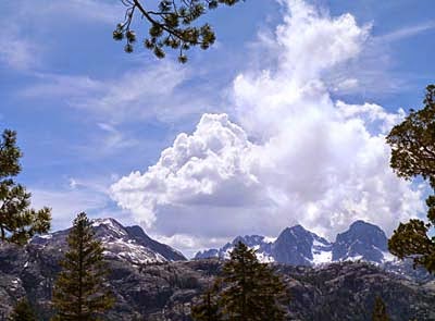 |
| This section of the Pacific Crest Trail had so many beautiful mountain views |
From what we experienced, the PCT isn’t nearly the shady ‘long green tunnel’ that the Appalachian Trail is. Portions of the trail were in the shade but much more of it was out in the open sun. All the hikers we met were covered in clothes, hats and globs of white sunscreen from head to toe and they all looked sunburned. David and I both got a bit of sun that day as well. My trail name could have been ‘Lobster Legs.’ Alas, I had on shorts…
 |
| Showing off my 'lobster legs' I learned my lesson and wore pants and long sleeves the next day |
Our time in the wilderness was just what
wilderness is supposed to be – a beautiful, primitive place untrammeled and
undeveloped by humankind with opportunities for plenty of solitude. We did pass a few other like-minded souls on
the trail but after a few words, we parted to follow our own journeys.
This year marks the 50th
Anniversary of the Wilderness Act. We
started our celebrations at the beginning of our journey this spring by hiking
in the very first wilderness, The Gila. It
all started in 1924 with Aldo Leopold’s influence on the forest service to set
aside that first 500,000 acres of the Gila for wilderness protection. In 1964 Congress passed the Wilderness Act
and now there are 758 designated wilderness areas in the country, totaling
almost 110 million acres – nearly 5% of the total U.S. land area. Although we will not visit every wilderness,
we plan to continue the celebrations by hiking in wilderness areas all year long.  |
| Mule ears, a beautiful composite flower with long, fuzzy leaves |

David's Stats:
Days Hiked 3
Total Miles Hiked 29.62
Ave. Miles per Day 9.87
Total Elevation Gain 4,395
Ave. Elevation Gain per day 1,465
Days Hiked 3
Total Miles Hiked 29.62
Ave. Miles per Day 9.87
Total Elevation Gain 4,395
Ave. Elevation Gain per day 1,465
 |
| 'Pussy paws' |
No comments:
Post a Comment