 |
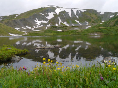
| View of Turquoise Lake at Molly Brown Campground |
 |
| Afternoon thunderstorm approaching Turquoise Lake |
David and I have always been “mountain people.” Beaches are fun for a few days, lakes are
nice but mountains and rivers hold our hearts.
However, if a pristine mountain lake is added to those mountains and
rivers, well, who are we to complain?
And that’s exactly what we’ve had this last week.
 |
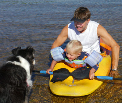
| David and friends Dustin and Melissa enjoying the lake with Maya and Rocky |
First, we stayed at Turquoise Lake near Leadville for 4
nights. We arrived on Sunday and felt
extremely lucky to get a camping spot at a forest campground on Turquoise Lake
called Molly Brown. This is high tourist
season in Colorado and we have found that our usual approach of not planning
very far in advance may not serve well, especially on weekends. Floaters, fishers, hikers, climbers, cyclists
and campers are out in force and we are thinking reservations may be in order
on weekends.
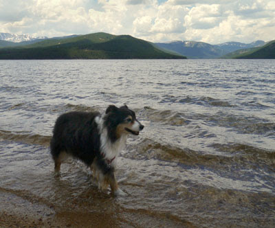 |
| Maya takes her own lake stroll |
 |
| Afternoon thunderstorms clear in time for some nice sunsets |
Our friends from Texas, Dustin and Melissa and their dog
Rocky, met us and they too snagged a place on Turquoise Lake just a few campsites
from ours. We had a grand time enjoying the
lake, cooking out and eating great food.
Every day we took a hike and each hike rewarded us with another lake or
two to see as well. Every afternoon
there were thunderstorms, some of them with heavy rain. Usually, the skies were clearing in time for
dinner and evenings on the lake were fantastic. One night Dustin and Melissa took us out to
eat at a very nice Leadville restaurant called, Treeline, to celebrate my
birthday. What a great birthday week!
 |
Rocky and Melissa enjoying Timberline Lake on one of our hikes
We couldn't take Maya on our longer hikes, but Rocky kept us company.
|
 |
| Beautiful Windsor Lake -- a steep hike but well worth it! |
 |
| Tall chiming bells on the Colorado Midland Trail -- a mountain railroad trail |
On Thursday, we moved on to Twin Lakes near
Colorado Hwy 82 (also known as the Independence Pass road, which is the highest
paved pass in the continental United States).
While we thought Turquoise Lake was more picturesque, Twin Lakes were clear
and beautiful, just a bit more out in the open.
We didn’t get a campsite on the lakes and didn’t really care as those
few spots were very sunny with no trees at all nearby. The lake view campsites up in the forest would
have been nice, but they were all full for the weekend and we would have only
been able to stay one night and then would have had to move. Instead we drove a little past the lake and
found a beautiful spot on the Roaring Forks River which feeds into Twin
Lakes. This worked out well as there was
plenty of shade for Maya so we could take hikes in the mornings.
 |
| A still morning on Twin Lakes |
 |
Twin Lakes were so still and gorgeous for our walk with Maya
We all had such a great time
|
One morning we felt very ambitious and decided to give the
nearby Black Cloud Trail a go. If we had
followed the trail all the way, we would have been on top of the highest
mountain in Colorado, Mt. Elbert at 14,433 ft.
We never really intended to summit because of the time it would take and
the afternoon thunderstorms. It was more
of a ‘scouting trip’ just to see if we might want to climb a “14er.” As anticipated, the morning was clear and
sunny but by 11:00 the clouds were already building. We were surprised and pleased with ourselves
that we climbed nearly 2,000 feet in under 2 hours. Only a little less than 3,000 more to
go! I suspect that every 1,000 feet
more would get slower and slower and harder and harder. The thinner air and exertion would have taken
its toll. We made it back for lunch with
Maya and were not too worse for the wear.
Maybe another time, we will conquer a “14er.”
 |
A view of Mt. Elbert reflected in Twin Lakes
We didn't get a picture on the trail as the summit
wasn't visible for most of the climb.
|
The next day we took Maya and hiked for a couple of miles
around Twin Lakes on the Colorado Trail which was also a shared trail at this
point with the Continental Divide Trail.
This lovely rolling walk was a nice counterpoint to the previous day’s
climb and it was so good to have Maya with us.
We miss her on the trails but we take her on easy ones whenever we can.
We are back in Leadville for a quick recharging
and grocery shopping. The Internet is so slow this morning, so I am not posting all the photos I wanted to show. I'll try another time. We are
going through Independence Pass to a campground near Aspen in a few minutes. Wish us luck.
Nothing over 35 feet can go through the pass and we will have to drive
Silver and the CRV separately to make it.
I have every confidence that Silver can do it, but I’m glad David will
be driving her and Maya and I will be following.
David’s Stats:
Days
Hiked 5
Total Miles Hiked 21.77
Ave. Miles per Day 4.35
Total Elevation Gain 4,616
Ave. Elevation Gain per day 923


